Wednesday, 24 August 2011

Dan Jones Bluff

The Gumdiggers Trail starts at Rothesay Bay
I was a tad late on Sunday, the weather was superb and we met at Valley Road car park in Browns Bay.

Alan from the Northcote Nordic Walkers joined us and was introduced to some of the North Shore Nordic Walkers before we started  our walk across Browns Bay Beach and onto the steps up to Dan Jones Bluff.  It was an extremely busy morning with heaps of people out walking with dogs on the beach and it can be a little disconcerting when a pooch comes over for an inquisitive sniff of your pole. 
In fact last year my walking buddy and I encountered a rather nasty dog out on Long Bay beach and my poles are now sporting teeth marks which I have neatly hidden using a strip of red insulation tape.  Actually it’s a great way to disguise chips and marks on your poles if they are starting to sport a few scars.
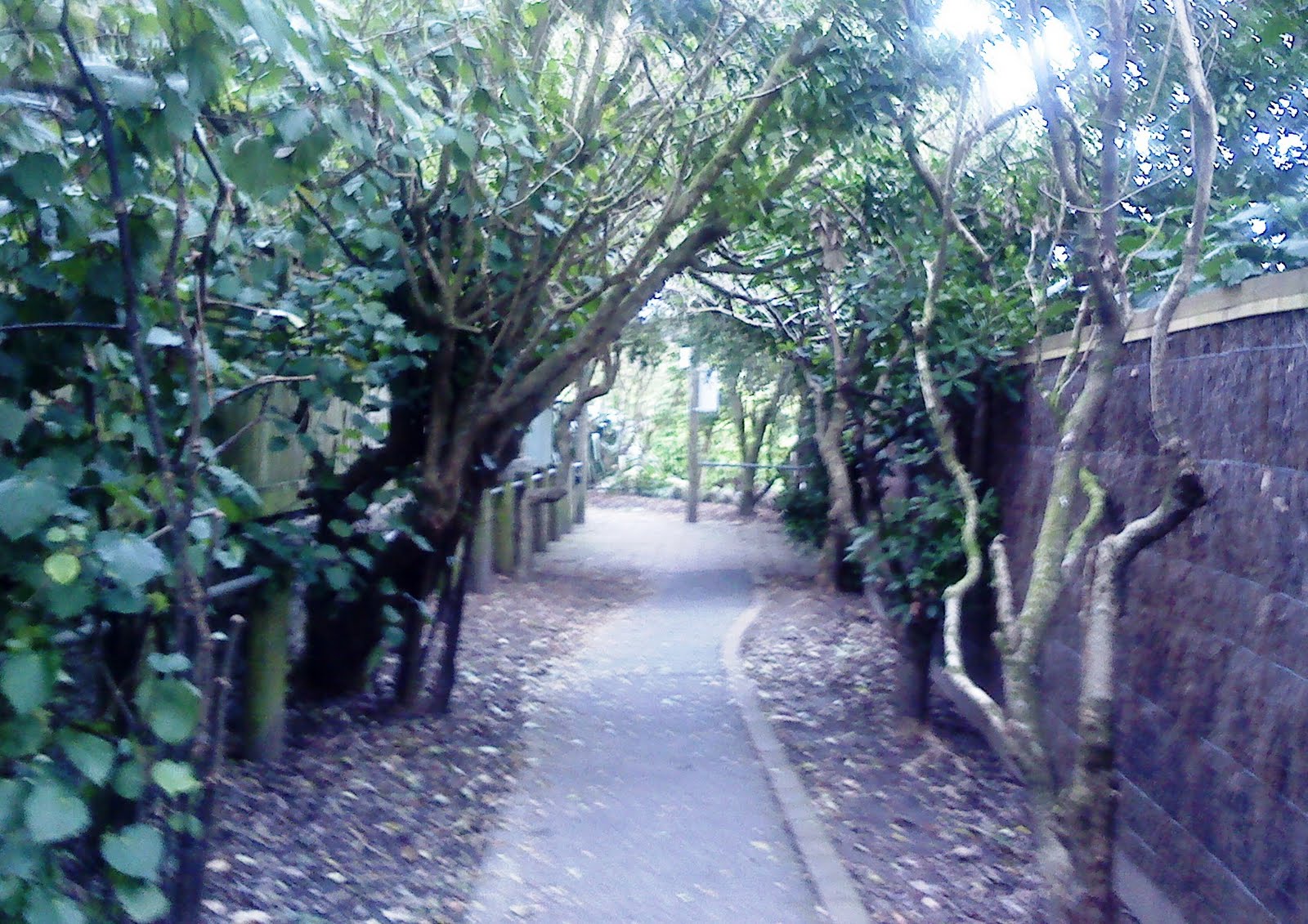
Cliff Walkway Rothesay Bay
The beaches on the Shore have clear rules about dog walking and I don’t think that a lot of people are aware of the restrictions, during certain hours dogs can walk with a leash - but must be under the owner's control - in parks, reserves and along the foreshores, dogs are allowed any time outside of daylight saving hours but are not to be exercised between 10am and 6.30pm during daylight saving on beaches, foreshores and public places within 20 metres of a beach (not including public footpaths).  The council website has a list of parks and public place where you can take your dog unleashed and where dog walking is prohibited.
The steps up to Beechwood Road are very steep and I advise unstrapping to ascend if you are not too confident either climbing or descending and to hold onto the hand rail for support. Once at the top of the walkway and past Dan Jones Bluff we started our walk to Rothesay Bay along the clifftop walkway.
The only interesting reference that I can find to a Dan Jones is an article about the Forfarshire, a ship that left with emigrants for Auckland in 1875, the ship’s captain was Daniel Jones.  He made his passage to New Zealand on 18th March 1875 from London in what appears to have been treacherous weather and the ship sustained some considerable damage.  They left London with 203 passengers and were at sea for 108 days and during that time they sailed though a terrible cyclone, they also sadly lost four children and an adult during the long voyage.  Once the North Cape was in sight the ship was anchored in the Tiritiri channel.  Perhaps the ship's captain is connected to the name of this area and I daresay that someone will tell me if I have the connection wrong but it’s an interesting piece of local history anyway and incidentally, the ship only ever made six trips to New Zealand.
Rangitoto from the Cliff top Walkway Mairangi Bay
We made our way along the pathway and onto Rothesay Bay and yep, the traffic cone was still  perched pertly on the same tree.  We crossed the road and turned left to take the Gumdiggers trail following the footpath into Murrays Bay, we briefly stopped at the toilets, then quickly made our way across the concrete causeway and into Mairangi Bay.  This is where we came across an elderly gentleman who was adamant that we were actually doing ourselves a great deal of harm using and relying upon our ‘walking sticks’, and despite us trying to convince him that the poles were part of an exercise regime and that we didn’t actually need to use them every day, he still continued to try and warn us about the probability of us having to use walking frames in the future because we were in fact training our brains to make ourselves reliant on walking aides! 
The Footbridge Campbells Bay
The sand at Mairangi Bay was quite soft and hard going underfoot for a while but we continued on over to Campbells Bay, where we took a picture of the footbridge that had caused a lot of kerfuffle a while back. Pam E posed on the controversial bridge for me, it’s really quite nice, but very small; and apparently cost an awful lot of money, but  it was built to provide a safe crossing over the creek during high tide.
We made our way back to Browns Bay without any further distractions and funnily enough we did see one old gentleman using a couple of walking sticks but we passed by without comment!
We had coffee at Ben Gusto and reluctantly made our way back to our cars, the cafe was really busy and the renovations outside made the cafe look even more appealing from the roadside, we may have to start our walks much earlier in order to grab a coffee there on a Sunday morning once summer sets in.
More Information & Sources:
http://freepages.genealogy.rootsweb.ancestry.com/~ourstuff/Forfarshire1875.htm
http://www.yesteryears.co.nz/shipping/pictures/forfarshire.html
http://www.searlecanada.org/sunderland/images/forfarshire1.jpg
http://www.searlecanada.org/sunderland/sunderland049.html
http://www.stuff.co.nz/auckland/local-news/north-shore-times/805647/Up-in-arms-over-footbridge


Wednesday, 17 August 2011

Long Bay Development

The outlook for Sunday’s weather was not good; in fact there was a weather warning issued for cold and windy weather for Auckland and snow had been forecast for the Northlands and the South Island.  As we now know New Zealand is currently having one of the coldest winters for a very long time.

Long Bay Beach popular with early morning dog walkers

North Shore Nordic Walkers met at Toroa Street and walked down along Cliff Road, onto the Oneroa Track and down to Long Bay beach.  The weather was relatively nice on the beach and we were sheltered; there were lots of dog walkers out and the beach was really quite busy.  High tide had left the beach littered with a few shreds of seaweed and lots of broken shell, making it pretty noisy going underfoot along the beach to the North end and by the time we had made it to the end of the beach the weather had really taken a turn for the worse.

North end of Long Bay Beach

It amazes me how quickly the weather in this area can change, the wind picked up and the sky became dark and heavy so we carefully picked our way across the beach and came off to wash down our poles at one of the water fountains set back on the car park by the park entrance.
We put on our tips and I guided the walkers up along Beach Road to the place where the diggers were working earlier in the week, the work along this road has been ongoing for a long while and lots of earth has been moved around to make way for the new development to be built on the hillside at Long Bay; the houses along the side of Beach Road have long enjoyed largely uninterrupted views of the hills for many years and sadly this is shortly to change.

World War II Pillbox uncovered on Beach Road, Long Bay
During the week Beach Road access to Long Bay was closed off to traffic and on one of my early morning Nordic Walks I had to take a diversion into Willis Street and then into Long Bay Drive to get down to the beach. The left side of the road at the bottom of Long Bay Drive had also been closed off and a digger was pulling away trees from the left side of Beach Road right outside someone’s property. Thinking that maybe that they were making way for new services I didn’t pay it much attention, until the day after when I drove past and saw what the digger had unearthed.  It was yet another World War II concrete pillbox, jutting out stubbornly on the side Beach Road, now that’s not something you see every day on the other side of someone’s garden fence.  It must have been there during the building of the property and maybe ‘landscaped’ on completion.
We stopped for a while and had a good look at it, and then we moved further along Beach Road and took a look at the latest development of this new site.  The area now has what looks to be a lake and it’s already looking like it’s been there a while, but there is an older property that is now visible since a lot of excavation work has taken out most of the old trees and bush.  The property looks like one of the original baches that were built in the area a long time ago, it’s a quaint weatherboard one story property, it seems quite sad and slightly out of place now.

Digger and heavy equipment at Long Bay

We looked out on the huge amount of land that has been excavated on the shear-key construction to accommodate the 2 hectare stormwater detention pond and wetlands. Some of the ladies reminisced on previous years when Torbay was a lot smaller and it was really a holiday destination for many families, this combined with the new road that will service Okura and Long Bay, Torbay will change dramatically over the next few years.

The changing landscape at Long Bay
As we started walking up the hill back to the cars, the heavens suddenly opened and we got a soaking, so we quickly made our way back to Toroa Street and grabbed our purses and walked back across the road to Torbay shops and ordered coffee at the Baker’s Gallery.  It’s little sad really, Torbay is a quiet suburb with local shops, doctors and dairies, I suspect a lot will change over the next few years, this small cheerful little shopping area will perhaps have to change to accommodate more homes and new families.  Whatever the changes will bring, I’m sure that we’ll still be down there at the beach regularly striding along with our poles, chatting and enjoying a coffee after our Nordic stroll.

Thursday, 11 August 2011

Te Araroa The Long Pathway

We’re very lucky here on this part of the North Shore known as East Coast Bays, as the area offers many walks along beautiful coastline, through open parks and bush walks. It’s a group of small suburbs that line the shores of the Hauraki Gulf and the Rangitoto Channel, they include the suburbs of Long Bay, Torbay, Browns Bay, Rothesay Bay, Murrays Bay, Mairangi Bay and Campbells Bay.

Valley Road Car Park, Browns Bay
 
The weather has been really wet so I’ve kept our Nordic Walks local over the last few weeks, so if it does take a turn for the worst whilst we are walking, then we’re not too far from home. Sunday wasn’t promising much in the way of sunshine so I arranged to meet the North Shore Nordic Walkers at Valley Road in Browns Bay. There’s a convenient car park just on the left as you drive down the road and it’s a great location to meet.

We trekked along the boardwalk facing Browns Bay Beach, the boardwalk is a recent addition to the Bay and makes walking with poles a bit tricky but it has improved the walk along the front. Starting at the North end we made our way along and across the little footbridge just the other side of the Bay’s Club.  Then directly opposite at the bottom of the beach and at the end of Browns Bay Road we climbed the steps to start our cliff top walk.
Browns Bay Boardwalk
Once at the top of the steps we turned left into Beechwood Road and followed the cliff top path, we walked past the beautiful houses that face the sea and past the hedgerows, it’s so neat to be able to walk past the gardens and a few obliging residents have thoughfully put out plastic containers and water for people walking with their dogs. The view  along the East Coast Bays coastline is dominated by Rangitoto and despite the weather threatening to rain we had spectacular views, a little misty but still very beautiful. This path that stretches to the next Bay is very popular with joggers and dog walkers and we say our hellos and good mornings as we pass Dan Jones Bluff and make our way down to Rothesay Bay.

The Cliff Top Walkway, Browns Bay
At the end of the path we were surprised to see that the cone from the previous couple of Sundays ago was still perched cheekily on top of the tree at Rothesay Bay, we crossed the footbridge past the park and walked up Rothesay Bay Road making a left turn into Churchill Road.  We then went through to the Gumdiggers Trail which leads onto the next cliff top walkway.  In the 1860’s Kauri gum exports were an important source of income for Maori and settlers particularly in the Northland and this trail leads up onto the cliff top walkway where we continued to follow the path down into Murrays Bay Reserve.

Murrays Bay is a nice little place; there are a couple of eateries and a pretty little walkway under the road which has been beautifully airbrushed by Jonathan Grange.
Dan Jones Bluff, Beechwood Road

The reserve carries upwards onto the cliff top and the footpath continues, but we decided to walk on along the man made causeway as the weather was good and the tide was out.  Now I’ve actually been along this path with another walking group in bad weather, it can be pretty treacherous underfoot here and shouldn’t be tackled in extremely wet weather or when the tide is coming in. The cliffs along here are also unstable and there has already been one fatality this year when a dog walker strayed under the crumbling cliffs. We made our way down to the beach and over the concrete walkway, then continued across the beach and walked to the far end of Mairangi Bay Beach.

Walkway Steps Murrays Bay

In the late 1800’s Joseph Murray purchased the land at Mairangi Bay from a local Maori, originally the area was full of Kauri trees and he collected the Kauri gum from the trees on his land. Then in the early 1900’s Murray sold the land to developers who subdivided it for holiday homes; the area then was originally known as Little Murrays Bay and Murrays Bay as we now know it was actually known as Big Murrays Bay. To avoid confusion the Little Murrays Bay was changed to Mairangi Bay when the Murrays moved from the area to Northcote. The name Mairangi means many things but its best known as “sheltered arm” which seemed most appropriate for a little community whose population was quickly growing, it’s now a thriving shopping centre with many cafes and restaurants.

Under Road Walkway, Murrays Bay

The walk took us about an hour and half and you can actually walk from Long Bay and make it all the way down to Devonport, which is ok if you want to scramble across rocks and pipes but it’s not ideal for Nordic Walking. I’ve managed to get a pole stuck in a couple of the footbridges along this route and in some parts it can be a little challenging.

Man Made Causeway, Mairangi Bay

We tramped our way back along the beaches and up across the cliff top paths, whilst some of the group took the footpath. We all met at Dan Jones Bluff and took our time to descend the steep footsteps back into Browns Bay.  We all had commitments for the rest of the day so we had no coffee or a muffin; I’m keeping my fingers crossed for a nice day this Sunday.

More Information & Sources:


Monday, 1 August 2011

Devonport Feature Walk

This Sunday I joined one of the Feature Walks around Auckland.  They’ve been organised by Paul and June Stevenson of Nordic Kiwi, www.nordicwalking.net.nz Myself and another North Shore Nordic Walker joined the expedition at the ferry terminal at Devonport.  The weather was very cold although dry and sunny so it was excellent weather for a guided tour around one of the North Shore’s oldest and important areas.

Devonport Ferry Terminal

Paul was most informative and we regularly stopped at frequent intervals whilst he gave us a talk about some of the history and pointed out various buildings or landmarks of general and historical interest. 

Devonport on the North Shore of the Waitemata harbour is a beautiful historical village traditionally used as a holiday resort, situated right on the sea front. It has three volcanic headlands in the area Mount Victoria and North Head with Mount Cambria situated between them and looking out across the waterfront from the Ferry terminal you can actually see remains of lava flows on the beach with the black oyster catchers strolling over the rocks showing off their unusual red beaks and red eyes.

The Flagstaff

Back in 1840 a flagstaff was erected at the top of the highest hill named Mt Victoria and the area then became known as Flagstaff. It was under the present flagstaff that Paul explained the importance of the area as the harbour is extremely deep and was suitable for a Naval anchorage so it became eventually known as Devonport after the English Naval town. Devonport is still the main base for the Royal New Zealand Navy and the dry dock opened in Devonport in the late 1800’s and for many years Calliope dock was the largest dry dock in the Southern hemisphere. Paul told us some of the history of the ferry terminal and thriving ferry services which are now operated by Fullers.
As we moved further along, Paul told various stories of interest and we stopped by a bronze memorial plaque where Lt Snow, his wife and daughter, were murdered at their home in 1847 on the original naval base.  The crew from the Naval ship Dido spotted Snow’s residence on fire and launched a  boat and at the same time Thomas Duder a Signalman from the Flagstaff who lived not too far away had also seen the blaze and made his way down to the scene.  Unfortunately it was too late, Lt Snow, his wife and one of his two daughter’s had been hacked to death and the house set alight. Thomas Duder and an associate were implicated in the murder but later an ex-shipwright Joseph Burns was arrested  and in 1848 he was convicted and sentenced to death.  The plaque stands at King Edward Parade today to commemorate the past events.  Paul also told us a great deal about the importance of Maori culture and history in this area and how archaeologists have found moa remains and evidence of ancient Maori existence.

Devonport is famous for it's orginal buildings
Further along our walk a number of buildings were pointed out to us, the area being characteristically colonial and retaining a lot of the local history of the area. Typically buildings were made from local timber and Devonport still has many of the original houses and buildings in situ.  The Masonic Tavern built in 1866 is on the corner of Church St and King Edward Parade, it remains one of New Zealand's oldest taverns although sadly it now seems that there are plans to develop this site into apartment blocks.
We saw many beautiful old residences on our trip up towards Mount Victoria and stopped by the Duder Homestead, originally built in 1860 as three terraced cottages which can be hired as a holiday home.
We climbed up the steps to Mt Victoria which was formerly the site of a Maori pa or fortified village of the local Kawerau tribe before the Europeans arrived. Today, you can still see remains of the terraces once protected by palisades of sharpened wooden stakes.  There are the most amazing views from the top of Mount Victoria of the Hauraki Gulf and Waitemata Harbour. At the top is Auckland‘s signal station and below is the Music Bunker which hosts Devonport Folk Music Club whose ventilation shafts are painted as brightly coloured mushrooms up top.  The bunker was built in 1891 to protect New Zealand from Russian Invasion and Paul told us that the gun was once fired but it caused so many windows to shatter in the area that it was never fired again.

Mushrooms at Mt Victoria

During our descent we passed through the Mt Victoria cemetery where we paused whilst Paul told us about Rangatira Eruera Maihi Patuone who died 1872 - he was 109! His grave is marked with a simple wrought iron railing and stone plaque. Patuone was a great leader and warrior, but he was also a peacemaker between the Maori people and the European settlers.

Paul took us along Victoria Road where we then stopped at Victoria Picture Palace Theatre built in 1912 by an American John Leon Benwell and it was one of the very first moving picture houses to be built. Recently it was disused and came under threat a while back of being converted into apartments but was rescued by the Original Victoria Theatre Trust who convinced North Shore City Council that they should buy the building and in 2003 the heritage group won the contract to lease the theatre and restore it to its original state. It is now showing films again.
Victoria Picture Palace Theatre

The Ploughman's Bakery traditional Clydesdale drawn wagon passed us by and I believe that some of the horses used to pull the wagon have featured in NZ television films such The Lion, The Witch and The Wardrobe and Zena Warrior Princess, the Clydesdales have also been featured by Tip Top as well as Ploughman’s for advertising.
Ploughman's Clydesdales Wagon
We had coffee at one of the cafes and Paul and organised a quiz.  I’m ashamed to say that I answered not one question despite being prompted by Judy my co-walker, I was too enthralled by my date scone and latte, but Paul was generous enough to give me the remaining chocolate frogs to give to the kids when I got in, Issy was very pleased with my winnings.
Further Information & Sources
http://www.devonport.co.nz/heritage.htm
http://www.savethemasonic.org.nz/welcome
http://devonportheritage.org/documents/VictoriaRd.pdf
http://www.devonport.co.nz/north_head.htm
http://www.tourismnorthshore.org.nz/id/1/top10/
http://www.townandcountryclydesdales.co.nz/