Showing posts with label North Shore Nrodic Walking. Show all posts

Friday, 11 April 2014

Sanders Reserve - The Faraway Tree


Pam F, one of our Nordic Walkers asked me to accompany her to a place called Sanders Reserve, she had recently taken a Women's Outdoor Pursuits course and did some of her bush survival skills here. She was so taken by this lovely location that she felt she had to show me the area,  I was pleasantly surprised, this is a gorgeous place and a fantastic area to visit for a family or a group outing.


The 'Faraway Tree" - Phil Bonham
Sanders Reserve is about 10 minutes from Albany, it's situated South of Paremoremo and located by the Upper Waitemata Harbour estuary; it's a splendid location, providing areas for dog walking and horse riding. It has a small walking track, a fabulous playground for children and heaps of mountain bike trails with breathtaking views.

Pam took me to see this tree (above) which is along the walking track by an area called Library Point. This is a Macrocarpa (Monterey Cypress) tree and was crafted by Phil Bonham, an Auckland artist and sculptor.

There a wonderful Vimeo clip of Phil talking about his work on the 'Faraway Tree' sculpture, it's a lovely short film that explains where some of his inspiration came from for the figures and animals that are featured in his work.

Take a look: http://vimeo.com/73850678

More information:

http://www.thebigidea.co.nz/work/resumes/133024-phil-bonham
https://www.facebook.com/media/set/?set=a.599621883423361.1073741838.301561623229390&type=3
http://en.wikipedia.org/wiki/Paremoremo

http://www.wops.co.nz/

Thursday, 21 June 2012

Browns Bay - Mairangi Bay

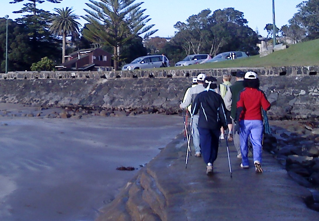
What a glorious day on Sunday and we had a good turn out too. North Shore Nordic Walkers met at Valley Road Car Park in Browns Bay, the sun was shining, the beach was very busy with dog walkers and the tide was on its way out. We poled across the sand to the steps at the Southern end of the beach to Beechwood Road and into Dan Jones Bluff.

Some of the North Shore Nordic Walkers at Browns Bay Beach
I noticed that the empty section at the top of the stairs had been cleared, it’s been neglected for years and it looks like someone is about to build a new home which would have spectacular views overlooking the sea and Browns Bay beach.

Steps to Beechwood Road - Section to the Right
We tramped in single file along the coastal pathway toward Rothesay Bay, where we picked up another Nordic Walker along the way.
The view from the Coastal Track at Murrays Bay
I love this walk. It’s mainly flat although once in Rothesay Bay there is a steep incline up the Rothesay Bay Road before turning left into Churchill Road and taking the Gum Diggers Trail onto Murrays Bay. The coastline is on the left with outstanding views of Rangitoto and the track is concrete all the way down to Murrays Bay Beach. There are three ways of crossing to Mairangi Bay from this point.  You can take the Crow’s Nest Rise Walk along the cliff, take Beach Road or use the man made causeway.  The tide was as I said on it’s way out so we crossed the causeway and made our way across the sand at Mairangi Bay.

Steps to the Gum Diggers Trial at Murrays Bay
I have written about this area in a previous blog Te Ararora – The Long Pathway. The Maori named this piece of land between Mairangi and Murrays Bays Waipapa, which means “water over wood" which was a reference to the stumps and logs left behind from ancient forest that were found in the sand around this area. In 1881 the name had been changed and the bay was renamed after Joseph Murray who farmed the kauri trees on his land between Mairangi Bay and Murrays Bay.

Nordic Walking at Mairangi Bay
The name Mairangi Bay (the sheltered arm) was chosen for the area as it seemed the most appropriate, and this Bay is a small but bustling village of boutique type shops and popular cafes.

The Concrete Causeway at Mairangi Bay
I bought my husband the White’s Aviation Arial photography book a couple of years ago, there are some stunning shots of this area in the book and much of the East Coast Bays on the North Shore in the 1950’s before the Auckland Harbour bridge was built. Check the links below for more information about Leo White and White’s Aviation Company and if you get the chance buy or borrow the book, it’s a great reference book and such an inspiring way to document the history of New Zealand, you can also get more information if you visit the library at MOTAT amongst many other places.

The Steps at Browns Bay to Dan Jones Bluff
We trudged along the beach past the Surf club where we stopped briefly for everyone to catch up before making our way back to Murrays Bay.

At Murrays Bay some of the group decided to take Beach Road back to Browns Bay whilst I and the others mounted the steps back to the Gum Diggers Trail, returning to Rothesay Bay and eventually back down the steps at Beechwood Road to Browns Bay beach.


Coffee at The White Flower, Browns Bay
We usually opt for Ben Gusto for coffee, but this week we tried the White Flower Cafe on Clyde Road, we had a bit of confusion over teas but the service was good and I had a very unhealthy chocolate caramel slice, yummy but made with desicated coconut - not keen.

Information & Sources:

http://www.mairangibayvillage.co.nz/community/mairangibayhistory
http://www.mairangibayvillage.co.nz/sitemap

Thursday, 9 February 2012

Rocky Road - Milford to Takapuna

The weather was great for Nordic Walking on Sunday and North Shore Nordic Walkers met at Milford Reserve.     
The reserve is opposite Milford beach but you can’t access Takapuna from Milford when the tide is in, so you either have to take the walkway round and up steps onto the road or as we did, walk through the streets and onto the main road, starting off at Kitchener Road and eventually turning into Hurstmere Road.

Milford Beach
Hurstmere Road in Takapuna is lined with restaurants, cafes and many boutique shops; it’s a busy location with many offices and local government establishments.  We ducked into one of the side streets which went down onto the beach, it eventually came up along the boat ramp and we made our way onto the walkway from the beach.
Along this road there are some magnificent Oak trees and gorgeous houses; one of these homes is Algie’s Castle, at 253 Hurstmere Road.  Captain John Alexander Algie came home from a visit to Scotland and had his his very own castle constructed.  It’s very impressive and has recently had a major refurb, originally it was called Merksworth Castle.
The pathways around this area are not fully constructed and can be very tricky to walk around, particularly if the tide has been in and the rocks are wet and can be extremely slippery underfoot.

Plaque at Takapuna Fossil Forest
We left the beach and walked along near the Boat Ramp cafe on the right, I can recommend the coffee there although it’s an extremely busy place and can be quite noisy if the tractors are heaving boats back and to.
A little further along we came across a couple of plaques with information about the fossilised forest where we stopped for a wee while. This area was forest and had been covered by lava some 100,000 years ago.  A crater that is now Lake Pupuke erupted and covered the area in hot lava which has left beautiful outlines and imprints of tree bark and leaves, some of them are ancient Kauri trunks and when the tide is out there are hundreds of tree stump remains visible from the boat ramp.

Lava at the waters edge and Rangitoto
Another plaque was spotted further on at the corner of the beach and O'Neills Avenue; it's dedicated to Allan Charles O'Neill another migrant from the UK and a civil engineer, he and another engineer John Logan Campbell completed the first survey and subdivided the Takapuna and Devonport area in 1843. O'Neill went on to to be the city Surveyor and Treasurer in 1854.
We walked along the pathway adjacent to the camping grounds in Takapuna and back along the coastline along the sea wall and onto the Giant’s Chair.  Now I must tell you that this walk is not for the faint hearted.   It can be very slippery in parts and it’s best to take your time or if you’re unsure take the side street and walk around. 

Some of our Nordic Walker's in the Giant's Chair
The Giant’s Chair was built around 1926  on the new sea wall, it was Captain Algie that created the chair with the same Basaltic rock possibly to compliment his Castle themed residence along Hurstmere Road, it’s an enormous chair and adds a little fun to the pathway.
We continued along carefully and picked our way along the rocks, eventually coming to the substation at Milford Beach where we could scramble onto a concrete path and back to the Reserve.  We stopped briefly outside one of the houses there that sports a rather stately looking giraffe sculpture, it’s a delight to see and stands in the lawn looking like it’s munching the tree tops, I’d not noticed it before as it blends in quite well in the garden.

Giraffe Hiding in the Trees - Milford
We Nordic Walked along the beach front and back to our cars, all thankfully in one piece and looking forward to our coffee.
We drove to Mairangi Bay and visited one of the cafes, where I was barked at by a small pooch, but after traversing the treacherous rocks between Takapuna and Milford, the little dog’s attempt to intimidate was somewhat lost on me!
Information & Sources: