Showing posts with label NZ Nordic Walking. Show all posts

Tuesday, 4 June 2013

Guest Post Pam F - Nordic Ramblers


Sunday was Queens Birthday weekend and the weather was glorious.
 
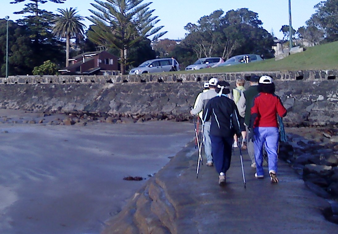
Our walk was from Browns Bay, I love walking the Bays but without the big hill climb over to the next bay so the group drove to Rothesay Bay to start the walk.
 
We made it!
Marie, Cindy, David, Mary, Natatia (my friend from Abu Dhabi)  and I were the Nordic Ramblers today.
 
The tide was very low and the water looked very inviting whilst picking our way along the rocky beach, Marie led the way. We were all hoping that we could get around the far point to reach Murrays Bay without taking a swim! A lot of care was needed as the rocks were very slippery. When turning at the very last point a massive rock blocked our way, we did manage to get by it eventually but as I was watching where I was putting my feet, I heard a scream. It was Mary who showed us a new slip and slide trick! She tumbled and ended up in a rock puddle (I hope that you don't have too many bruises Mary) we were so glad that there were no broken bones. The walk along the rocks is not for the faint hearted, I think next time we’ll stick to the Coastal Track.
 
We continued walking along the beaches until we reached Campbells Bay where we turned around. Marie was wearing a Milford Track beanie and as I was being keen to walk the track one day I asked about the Great Walk. Marie told us a story of a fellow tramper who left their tramping boots outside the hut after being told not to do so. It seems that the *Keas like boots! Cutting the story very short, in the end, the tramper had to be air lifted out minus the boots!
 
The beach is a great playground for the dogs on Sundays when it's quiet.
 
Our return walk was by the costal walkway and enjoyed by all. We all happily made our way back for a cuppa at Browns Bay.
 
Note: For your information, the route that Pam and the Nordic Ramblers took is part of the North Shore Coastal Walk.  This walk is accessible during low tide only and care must be taken when passing, not only are the rocks slippery when wet but the cliffs along this route are extremely unstable.
 
If you would like to try some of this walk, take a look at this website: http://www.teararoa.org.nz/auckland/north-shore-coastal-walk/
 
*Kea (Nestor notabilis) is a prevalant parrot of the South Island.

Tuesday, 10 July 2012

Unsworth Heights - Jack Hinton Drive

Unsworth Reserve
North Shore Nordic Walkers met at Jack Hinton Drive, Albany on Sunday.  It was freezing and frost was still clinging to the ground at 8.00 am as we made our way across Rosedale Park.

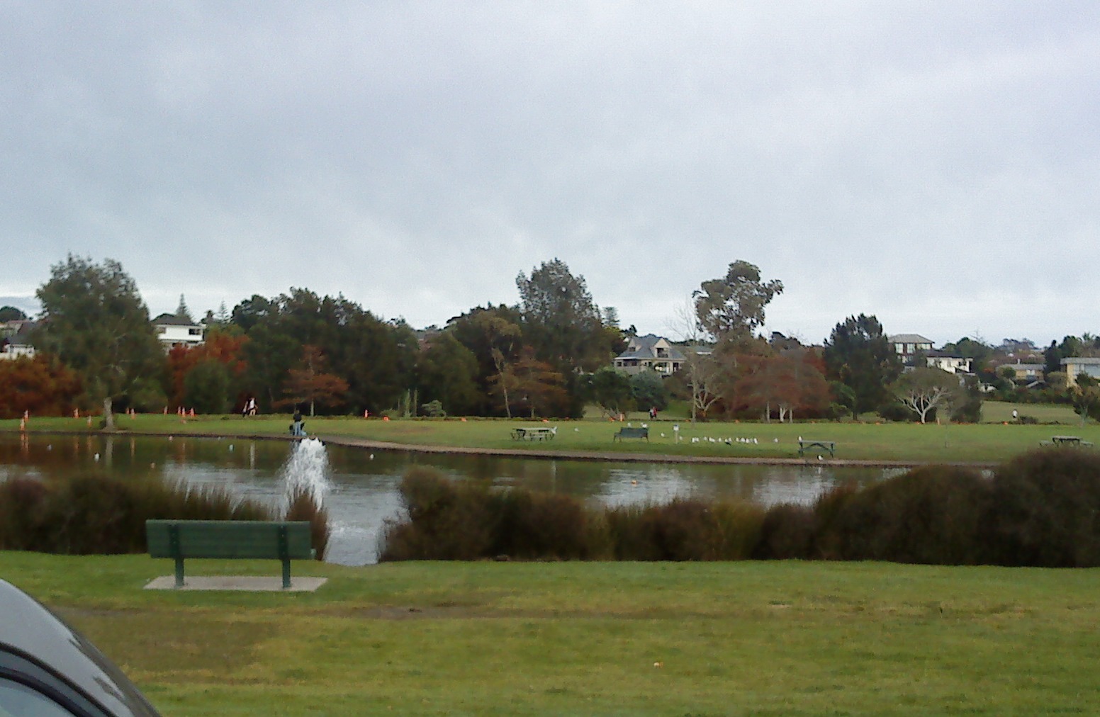
We passed the cable works and some interesting works being undertaken for the new stadium, continuing past the duck pond and crossing at Paul Matthews Road to take the tunnel through to Unsworth Heights.

Walking Through A Very Frosty Rosedale Park
Jack Hinton was a soldier in WWII who received the Victoria Cross. He was born at Colac Bay in 1906 and joined up in September 1939. Hinton, tired of retreating from a column of German soldiers that had arrived at the port of Kalamata Greece in April 1941, launched an impressive attack by throwing a couple of grenades at the soldiers who fled from their posts. He then led a group of New Zealanders into an attack and they managed to chase the garrison into nearby houses.  They then held the guns and position until they were overwhelmed by German soldiers and unfortunately Jack was shot.

Mist On The Duck Pond At Unsworth Reserve
Jack became a prisoner of war in prison camps in both Greece and Germany.  Apparently he was quite a character and did undertake several attempts to escape. The Kommandant presented him with a copy of the VC medal and offered celebratory champagne at his officer’s club to which Jack is reported to have told the Kommandant to put his champagne up his waistcoat.  After the war he returned to New Zealand and passed away in Christchurch in 1997.

We walked through the bush to the boardwalk which has been finished, but it was very slippery and we had to take great care crossing most of the wooden walkways as a lot of them have metal mesh, which when frozen become quite treacherous.

At the end of the boardwalk we congregated at Barbados Drive and waited until everyone had caught up.  We crossed the road and then followed the pathway into Unsworth Reserve. A lot of work is still going on in this area and the pathways and bush have been cleared.  It looked quite strange and solemn as the frost was still on the grass and trees whilst the storm water pond being home to dozens of ducks was swirling in mist.

Caribbean Drive
It was at this point that some of the group suddenly stopped, we realised that we had left people behind and one of our walkers was most definitely having problems.

This area is in the Albany basin and in winter can be exceptionally cold - certainly more than the surrounding areas.  I headed back to the group and one of the ladies was visibly distressed. She was in pain, wasn’t coping well with the cold and her circulation to her hands had suffered.


Some of our ladies turned back with her to one of the local cafes and Margaret kindly stayed with her until she had fully recovered.

Making Our Way Back
Auckland’s weather can be deceiving as some parts can be mild whilst other parts can be very cold. Having endured lots of terrible winters in the UK and also suffering with “White Finger or Raynaud’s Syndrome” and the consequent chillblains, I can appreciate the great discomfort that poor Pam was going through.

I want to share some advice when out walking in cold weather.  Wear layers, invest in a couple of Merino tops or polypropylene, use good quality socks, wear a hat and wear gloves. I know some people don't like getting over heated so carry a pack that allows you to take off layers as you go. I had a friend that knitted me cuffs to wear in winter and ladies need to wear long pants, preferably lined to keep in the heat, don’t wear jeans. Try wearing a gillet under your jacket as an insulating layer, keeping the core warm is essential, and keep moving.

Some Of The Reserve Has Been Re Landscaped - Look At The Mist!
We quickly continued our walk and headed to Cafe Drina just on Paul Matthews Road where the ladies had gone for a warm. We were all relieved to see that she had recovered well, the staff were very kind. We stayed a while for a chat over coffee and I had my usual English Breakfast Tea with poached eggs on toast, most definitely with a hint of vinegar this week.


Information and Resources:
http://www.nzhistory.net.nz/page/jack-hinton-wins-victoria-cross
http://www.stuff.co.nz/southland-times/news/features/southern-military-history/3918686/Who-ll-come-with-me

More on Walking in Cold Weather: http://www.mayoclinic.com/health/fitness/HQ01681/

Thursday, 21 June 2012

Browns Bay - Mairangi Bay

What a glorious day on Sunday and we had a good turn out too. North Shore Nordic Walkers met at Valley Road Car Park in Browns Bay, the sun was shining, the beach was very busy with dog walkers and the tide was on its way out. We poled across the sand to the steps at the Southern end of the beach to Beechwood Road and into Dan Jones Bluff.

Some of the North Shore Nordic Walkers at Browns Bay Beach
I noticed that the empty section at the top of the stairs had been cleared, it’s been neglected for years and it looks like someone is about to build a new home which would have spectacular views overlooking the sea and Browns Bay beach.

Steps to Beechwood Road - Section to the Right
We tramped in single file along the coastal pathway toward Rothesay Bay, where we picked up another Nordic Walker along the way.
The view from the Coastal Track at Murrays Bay
I love this walk. It’s mainly flat although once in Rothesay Bay there is a steep incline up the Rothesay Bay Road before turning left into Churchill Road and taking the Gum Diggers Trail onto Murrays Bay. The coastline is on the left with outstanding views of Rangitoto and the track is concrete all the way down to Murrays Bay Beach. There are three ways of crossing to Mairangi Bay from this point.  You can take the Crow’s Nest Rise Walk along the cliff, take Beach Road or use the man made causeway.  The tide was as I said on it’s way out so we crossed the causeway and made our way across the sand at Mairangi Bay.

Steps to the Gum Diggers Trial at Murrays Bay
I have written about this area in a previous blog Te Ararora – The Long Pathway. The Maori named this piece of land between Mairangi and Murrays Bays Waipapa, which means “water over wood" which was a reference to the stumps and logs left behind from ancient forest that were found in the sand around this area. In 1881 the name had been changed and the bay was renamed after Joseph Murray who farmed the kauri trees on his land between Mairangi Bay and Murrays Bay.

Nordic Walking at Mairangi Bay
The name Mairangi Bay (the sheltered arm) was chosen for the area as it seemed the most appropriate, and this Bay is a small but bustling village of boutique type shops and popular cafes.

The Concrete Causeway at Mairangi Bay
I bought my husband the White’s Aviation Arial photography book a couple of years ago, there are some stunning shots of this area in the book and much of the East Coast Bays on the North Shore in the 1950’s before the Auckland Harbour bridge was built. Check the links below for more information about Leo White and White’s Aviation Company and if you get the chance buy or borrow the book, it’s a great reference book and such an inspiring way to document the history of New Zealand, you can also get more information if you visit the library at MOTAT amongst many other places.

The Steps at Browns Bay to Dan Jones Bluff
We trudged along the beach past the Surf club where we stopped briefly for everyone to catch up before making our way back to Murrays Bay.

At Murrays Bay some of the group decided to take Beach Road back to Browns Bay whilst I and the others mounted the steps back to the Gum Diggers Trail, returning to Rothesay Bay and eventually back down the steps at Beechwood Road to Browns Bay beach.


Coffee at The White Flower, Browns Bay
We usually opt for Ben Gusto for coffee, but this week we tried the White Flower Cafe on Clyde Road, we had a bit of confusion over teas but the service was good and I had a very unhealthy chocolate caramel slice, yummy but made with desicated coconut - not keen.

Information & Sources:

http://www.mairangibayvillage.co.nz/community/mairangibayhistory
http://www.mairangibayvillage.co.nz/sitemap

Thursday, 31 May 2012

Northcote Tuff Crater

The Tuff Crater Restoration Project
The weather on Sunday was ok, despite the downpours during the week the weekend wasn’t too bad at all. It was just as well as I had been advised that the Northcote Tuff Crater (also known as Tank farm) and Onepoto Basin walk was treacherous underfoot when wet.  I was hoping to have a local with us as a guide but unfortunately they were unable to make it so we tramped on regardless.

View from the look out at St Peters Street
The North Shore Nordic Walkers met at the Library at Northcote at 8.00 am.  We walked down College Road crossing over to number 77 turning right onto the walkway in St Peters Street; we stopped at the Crater lookout and then turned right onto the track which was mostly gravel, boardwalk and around wetland. Further on we crossed onto the grass adjacent to the motorway.

Boardwalk around the Crater
Onepoto, (Maori for short beach) is a volcanic crater or maar on the North Shore situated near to the approaches to the Auckland Harbour Bridge, The 26 ha crater is the result of a number of massive eruptions about 250,000 years ago. It first emerged as a freshwater lake, then later became a tidal lagoon when sea levels rose after the last ice age. The crater floor has been reclaimed and now has a sports field, a children’s playground and a lake surrounded with beautiful native bush.  Some areas of the tuff were quarried away in the 1950s to obtain landfill for the Northern Motorway. The tidal Onepoto Stream runs through the swamp under Onewa Cycle Bridge near Waitemata Harbour.

 View from the Motorway Bridge
This area was also known as Tank Farm - the name comes from the  petrochemicals storage tanks which were located here during World War II.
Onepoto Domain
At the end of the walkway we climbed up the steps onto the motorway bridge to take a look at the traffic zipping past; the view of the city is spectacular from the footbridge.  From the bridge we walked back across the grass and past the Pumping Station on the left. Taking a right between the houses we walked though to Heath Ave. Following our map we headed right down Sylvan Avenue where we crossed over to number 72 and along the track to Onepoto Basin. We followed the track through the park to the playground then we heard the loud speakers, Auckland Run Series were having one of their events and we arrived in the middle of it. Curses. Mental note - must check the events calendar for future walks!

Children's Playground
We stopped to look at our map when a helpful young lady came along and gave us directions to another walkway to take us to Northcote Tennis club, unfortunately it clashed with the runners and we tried to find an alternative route. Grace found us a track between the houses but it circled back further along the street so we ended up back in the race;. Curses again. Anyway we meandered for a wee while before deciding to walk facing the runners along the street and exiting Exmouth Road before turning right into College Road and back to the library.

The Lake
We walked though to the shops and found a lovely cafe for our coffee, I had very yellow eggs on toast and was told that they were probably organic although I don’t know as my Nan would say "eggs is eggs", but they tasted superb!

Information & Sources:

http://www.sciencelearn.org.nz/Contexts/Volcanoes/Sci-Media/Animations-and-Interactives/Volcano-map-of-New-Zealand

http://www.theaucklander.co.nz/news/slow-boat-to-danger/1018200/

http://en.wikipedia.org/wiki/Onepoto_(volcanic_crater)

Wednesday, 23 May 2012

World Nordic Walking Day 2012

New Zealand


This is the third year of the World Nordic Walking Day event, and New Zealand was the first country to commence the celebrations at the Sir Peter Blake Marine Educational and Recreational Centre at Long Bay, Auckland on the North Shore and hosted by Paul and June Stevenson our INWA representatives. The centre is ideally located with fabulous views of Long Bay beach and cliffs, and a great venue for our event.

The Sir Peter Blake Marine Education &Recreation Centre
Despite the cold and wet weather the previous day we had a great turn out and the weather improved as we met at 8.30 am and separated into our groups for the two walks starting at the beach. There was a 45 minutes walk through the park and back and a 90 minute walk organised to go up the cliff past Granny’s Bay.

Taking Poles to Long Bay Beach
Long Bay beach is a kilometre long and to start the celebrations of our unique exercise of Nordic Walking we warmed up with some exercise on the beach then walked to the North end to walk across the park, along the grass and towards the Vaughan Homestead. 

Warm up on the Beach
The homestead is over 100 years old, made of New Zealand Kauri and Puriri native wood. It stands overlooking the beach at Long Bay with magnificent views of the park. We lingered a while to look at the view before taking the nature trial through the bush and separating into our groups. 

Vaughan House Greensleeves - Caught you Sheila
Our group led by Paul and myself walked through the cattle gates across the trail and onto the cliff top. The views are simply magnificent, it’s quite slippery along the rest of the cliff track here and we picked our way carefully through the mud and wet grass to a great viewpoint - someone was surprised that they could see the lighthouse at Tiritiri Matangi Island.

We returned to the track via the Nature Trail and through the park, taking a toilet break along the way and then back down the beach to MERC at the South end.

Top of the Cliff before Pohutukawa Bay
At the centre we had a quiz, speeches and acknowledgements for Nordic Walkers that had achieved their personal goals by entering events.
Paul Stevenson gives the Message from INWA President Aki Karihtala
All of the speakers were Nordic Walkers and most had very personal and interesting experiences to share with us.  It was a great fun morning and we are lucky to have some strong Nordic Walking groups across Auckland; we did have Nordic Walkers visit us from Rotorua too.  It was a great opportunity to catch up with some of the other groups and Walking Group Leaders and exchange walking ideas and walk plans.

Bronze bust of Sir Peter Blake
The morning went so quickly I felt like I didn’t get the chance to speak to everyone that I would have liked to, but it did give me the opportunity to meet some of our new Nordic Walkers. June mentioned one of our instructors Sandrine Smith is leading a team for the Arthritis NZ marathon and I will also be taking part and are looking for more participants.  If you want to know more about the event or sponsor our team, The Nifty Nordic Walkers here’s our details: http://ow.ly/b5man. Thanks!


Wednesday, 9 May 2012

Kell Park - Kaipatiki

Sunday brought the North Shore Nordic Walkers cold autumnal weather, it was a grey and cloudy start, but at the end of our walk the sun had cracked through. We met in the library car park at Kell Park, Albany. This park is becoming quite a favourite walk, it’s fairly flat and runs adjacent to Lucas Creek. I’m not sure if I have mentioned this before but Albany is actually from the Gaelic name Alba, which is the Gaelic name for Scotland.

The Landing used in the past as a terminus for boats travelling to and from Auckland
I did organise a trip to Albany Trig, it’s actually across the road from Kell Park, but the pathway is being repaired at the moment and it’s very slippery underfoot. If you do visit the Trig, take somebody with you as it’s very steep in places and you will have to cross the creek; there is no bridge but it is do-able just take your time and stick to the path. If you make it across there is a lovely waterfall with a picnic table and seats situated just opposite the fall.

To start the walk we turned left and down the steps, turning left again at the bottom of the steps and over the bridge. Walking through the park and past the houses on the left then continuing along the path and onto the Landing area.
Lucas Creek
In the past there was a small Pa situated North of Lucas Creek where Maori would hunt for crayfish and eel, the land around this area was known as Kaipatiki which means 'to eat flounder', or the 'feeding ground of the flounder'.

Many wharves were built around the Landing as water travel was the most common way to transport goods, to travel to and from Auckland, and to travel around the North Shore. The Landing certainly became the most used terminus but was demolished in the 1930’s and has over the years been developed as a residential area.
Massey, Albany Campus
Taking a a right turn once we emerged from The Landing we continued following the footpath along the Albany Highway past Albany Campus, Massey University on the left.
We walked down Bass Road and through the streets to Kinleith Way, had a joke about dropping in for a cuppa at Margaret’s house but pushed on, eventually walking through a small entrance between the houses, following the path alongside the Creek.

The bush and trees along this pathway are full of birds, and it’s interesting to note that many of the  properties overlooking the Creek are laden at this time of year with fruit. I had never seen citrus fruit growing in gardens before I moved to NZ.  Even in Greece and other European countries the fruits I have seen are generally grown in orchards.
The Creek Surrounded by Native Trees and Bush
We crossed the Creek at a small bridge taking the path back onto Albany Highway and  walked back towards The Landing. Small platforms or jetties have been erected along the waterside presumably for fishing and there quite a few ducks out on the water.
The Massey Campus car park was deserted - a strong contrast to what it normally looks like during the week.  Built over 15 years ago the Campus is a huge establishment with a Spanish architectural theme, it’s one of the most modern Universities in New Zealand.

Canon at the top of the Flying Fox
We ambled along the pathway and back into Kell Park where we stopped for while and watched Pam E chicken out of riding the Flying Fox, but I spotted a white duck out on the water so we headed over to take a look. Its a great place to take the kids with a huge slide and cannon for them to explore.

Wooden Sculpture at Albany
We finally made our way across the grass to the children’s play area and had chat by the  bronze sculpture in Albany village square but somehow our cafe arrangements got confused and Cindy and David wandered down the road whilst the rest of us had a muffin and a beverage at the Opium Cafe.  
The lifesize rooster and chair was created by a local artist Joanne Sullivan-Gessler in 2004. It appears that the rooster has attracted some attention from thieves in the past and the life sized sculpture has had a couple of attempted thefts. It must be really heavy and I can't imagine that it would be easy to remove without the use of some kind of equipment.

'
'Balance' Rooster Sculpture at Albany Village Square
Anyway I had  a berry smoothie and someone asked what was in it. Apparently it is made of berry concentrate and vanilla powder mixed with ice. Think I may stick with Lemon & Ginger tea on our next visit.

It’s worth mentioning at the end of this week’s blog that I did actually go out on Saturday night to a party, and was rather jaded on Sunday morning. After our walk and on returning home I found I had spent the whole morning walking with my pants on inside out and nobody told me!  Seems that wearing your clothes inside out is supposed to be very lucky, not sure who for though!

Next Sunday I will have the said walking pants back on the right way around!
Information & Sources

http://www.harboursport.co.nz/site/harsport/files/ACOM/albanyandlucascreek.pdf

Tuesday, 24 April 2012

Hobsonville Point

Last week we had a local walk and I didn’t really have much to say about it, but this Sunday North Shore Nordic Walkers met at Hobsonville in the morning; we parked opposite the Catalina Cafe and it was quite an adventure. I copied a map from the Internet to try a walk around Hobsonville Point. Unfortunately some of the walk had been interrupted by earthworks for new housing and school development and a good portion of it wasn’t easy to access.  The place was really busy though, they have a traditional farmers market on a Sunday at 9.00 am and the place was already bustling as we passed through.

The Catalina Cafe
We crossed over the road at the Corner of Buckley Ave and Hastings Crescent and walked around the back of Catalina Cafe. We poled past the community plant network garden, down past the children’s playground and past many of the old service buildings.   

The Quaint Church or Pump House
Hobsonville Point was previously the Royal New Zealand Air Force airfield, set aside for development at the start of the millennium and is now emerging as a new semi rural suburb of Auckland, located on the North Western shore of Waitamata Harbour and named after the first governor of New Zealand.

Signposts around the Coastal Walk Path
Originally the area was used for farming, what I found interesting and a few of our walkers commented on, was that the earth that had been dug up by the bulldozers was mainly clay.  Apparently there were clay and brickworks in the area and most of the pipe work in Auckland would have been made there.
Some of our Nordic Walkers at the Landing
In the 1920’s the Royal New Zealand Air Force built the airbase which later joined up with Whenuapai airfield. Later in the 1930’s the air strip was evidently too short and the area was used as a repair and equipment utility.  Eventually in early 2000  the RNZAF relocated most of its logistics and operations elsewhere.
Walking through the old air base was really kind of eery, we all had that feeling that we shouldn’t be there, there were lots of signs stating that the area was strictly for Defence personnel only.

We made our away across the tarmac path and down to the Landing, this area was used by the old seaplanes, it’s a small concreted area that faces the sea, this will become the new Hobsonville wharf and ferry terminal.

View from the Landing
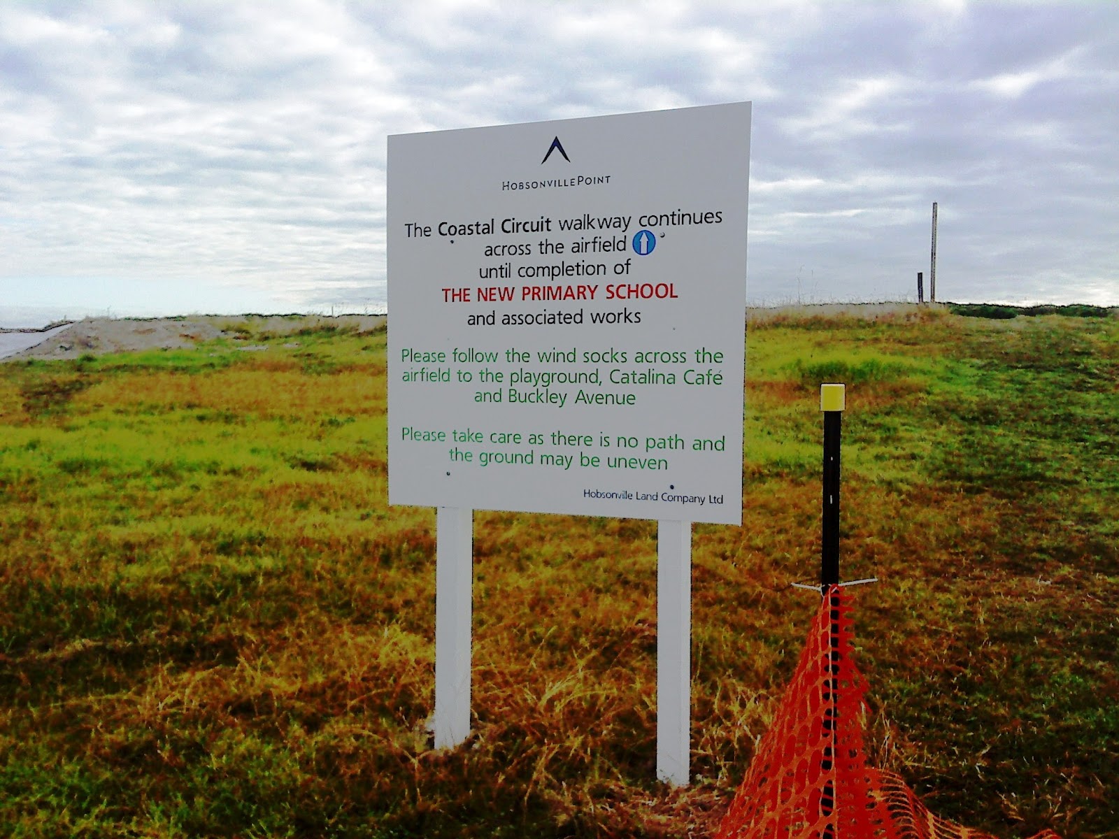
Eventually we came across signposts that lead us onto Bomb Point, it looked like there was a path in the grass and another walk.  We didn’t venture down the path but continued to the airfield where a sign told us to look out for the wind socks. Well with no wind socks in view we picked our way across the building site and walked across to where the new primary school would eventually be built.

Sign for Bomb Point which wasn't half as exciting as we expected
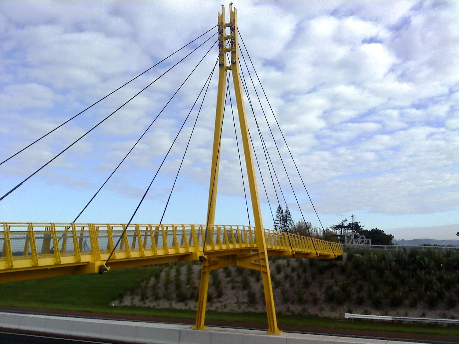
It was at this point when we came across a couple of ladies we saw earlier on the car park outside the Catalina cafe. I asked about any further walks and they pointed us in the direction of the yellow bridge so away we tramped, passing a pump station that we thought at first was a small church. We crossed over the road and made our way across the Memorial Park and onto Clarks Lane Footbridge.

Not a single windsock in sight!
The bridge is indeed canary yellow and is tiled at the edges with beautiful details, each tile along the end had some cycle or truck tread artwork being the creation of Matt and Kate McLean. They have been put together most decoratively and add a lovely touch to what could have been a boring path across a very busy highway.

From the bridge you can see what would have been some of the homes used by the pilots whilst working at Whenuapai airfield.  Mary pointed out some of the traditional houses and from where we stood we could also take a good view of the Sinton Windows Sculpture which was apparently created using recovered materials.
Clark Lane Footbridge
We were now ready for a coffee so we headed back past the park towards the cafe, however as usual we were distracted by the new housing development and took a slight detour to have a nosey at the new homes. 
Once satisfied that we weren't missing anything we ventured back past a lovely kiddies playground and onto the Catalina Cafe.

Matt and Kate McLean Tiles
The cafe was doing a roaring trade with hungry shoppers and walkers, however the queuing was short and service was fast, and I had two poached eggs on toast with lemon and ginger tea!  Some of the group went off to see the farmers market and the remainder made our way back to the car park.

Sinton Windows Sculpture
I think we’ll be returning to Hobsonville as it’ll be interesting to see the finished result - I might even go back and explore some of the other paths.

Information and Sources:
http://www.arc.govt.nz/albany/fms/main/Documents/Council/Consents/Notified%20applications/HobsonvilleLandco/Appendix%2010-21/Appendix%2010%20-%20Archaeological%20Assessment.pdf


Tuesday, 13 March 2012

Te Ara Tahuna Estuary


Estuary Cycleway and Walkway
Sunday was a wet day and I debated as to whether or not the walk should be cancelled.  I had arranged to meet some of the North Shore Nordic Walkers locally and others at the i-site at Orewa. Very often the weather can be atrocious in Auckland overnight then in the morning it can clear, at 6.30 am it was still bouncing down and rather cold.  I decided to carry on and the weather was fine, although still damp and colder than recent but the rain held as we walked around the estuary.

We started the estuary walk from the i-site car park and worked our way inland along the path, it’s a great walkway shared with cyclists and dog walkers.  The path is skirted by houses, some of which are big with spectacular gardens and views overlooking the water.  The concrete path is divided into a cyclist section and a walkway for pedestrians and cheerily shared by all.  We often stop and talk to people on our walk around as  the path is easily negotiated and reasonably flat, it’s also used for many walking and running events.  After a circuit of the estuary the path leads under the road bridge to the sea side where you can carry on past the camping grounds and walk down to the Surf Club and beach.  Today we walked along the estuary only and we had a new walker join us who already knew one of our regular walkers and she slotted in quite easily.

Garden at Orewa Estuary

We poled our way around the far side of the estuary past one of our favourite houses where the owner obviously takes great pride in their garden, it’s extremely ornate with lots of ornaments and little features dotted around the open garden.  We walked across the bridge, the native flax and lillies are starting to fade now but still dominate the water's edge.  We walked past the new housing complex, continuing along the path past Silverdale PrimarySchool and onto the bridge just outside Kingsway College. A little further along this path we bumped into June and Paul Stevenson taking the ‘Nordic Edge” class along the estuary.  It’s a great location for training, parking is easy and simple to measure your time and distance; if you get a chance to take one of the training classes I do recommend them.

Cycleway and Walkway
We continued along on the Southern side of the estuary past the new houses to the bridge and up onto the road bridge where we watched the tide coming in for a while as it came in really quickly.

The third bridge here was built in 1999, on the site of the first original wooden bridge that was built around 1881.  The second bridge was cleverly designed some fifty years later, there were no roads as such and water transport was used extensively which was a problem at Orewa river mouth.  The engineers however designed a turntable which allowed boats with masts to pass through.  Then as time progressed and road transport increased, the bridge became unsafe, a sharp turn caused many accidents off the road onto the bridge, so the larger bridge that is here today was developed that removed some of the dangerous curve out of the road. We walked back to the i-site car park, altogether this walk takes about an hour and a half and is roughly around 7.5 km; an excellent way to blow the cobwebs away on a Sunday morning!

Lillies along the Estuary
As I packed away my poles I noticed a lady unpacking her poles, they weren’t Nordic poles so I asked her if she had been walking long. In fact she hadn’t as she suffered a broken ankle in December and was still struggling but had read about Nordic Walking and decided to have a go to see if it helped with her recovery. Not one to miss an opportunity I instant whipped out a card and invited her to walk with us sometime and to take a class.  It’s amazing how many people actually buy tramping poles, I hope she was OK they looked way too tall and heavy for her!

Bank of the Estuary
We decided to try the cafe in the Estuary Art Centre, it was a bit slow as they were only able to make one coffee at a time and that meant we all drank at different times, but I did have the smoked salmon bagel which was rather tasty and I didn’t have to wait long at all.  We didn't have the chance to take a look around the exhibition, I was told that the centre was originally a Kentucky Fried Chicken emporium.  It certainly was a great venue for an art gallery, set on two floors with the upper floor immediately accessible by the entrance and the cafe occupying the space by the entrance.

We will have to have an explore of the gallery sometime!