Showing posts with label New Zealand. Show all posts

Friday, 11 April 2014

Sanders Reserve - The Faraway Tree


Pam F, one of our Nordic Walkers asked me to accompany her to a place called Sanders Reserve, she had recently taken a Women's Outdoor Pursuits course and did some of her bush survival skills here. She was so taken by this lovely location that she felt she had to show me the area,  I was pleasantly surprised, this is a gorgeous place and a fantastic area to visit for a family or a group outing.


The 'Faraway Tree" - Phil Bonham
Sanders Reserve is about 10 minutes from Albany, it's situated South of Paremoremo and located by the Upper Waitemata Harbour estuary; it's a splendid location, providing areas for dog walking and horse riding. It has a small walking track, a fabulous playground for children and heaps of mountain bike trails with breathtaking views.

Pam took me to see this tree (above) which is along the walking track by an area called Library Point. This is a Macrocarpa (Monterey Cypress) tree and was crafted by Phil Bonham, an Auckland artist and sculptor.

There a wonderful Vimeo clip of Phil talking about his work on the 'Faraway Tree' sculpture, it's a lovely short film that explains where some of his inspiration came from for the figures and animals that are featured in his work.

Take a look: http://vimeo.com/73850678

More information:

http://www.thebigidea.co.nz/work/resumes/133024-phil-bonham
https://www.facebook.com/media/set/?set=a.599621883423361.1073741838.301561623229390&type=3
http://en.wikipedia.org/wiki/Paremoremo

http://www.wops.co.nz/

Tuesday, 4 June 2013

Guest Post Pam F - Nordic Ramblers


Sunday was Queens Birthday weekend and the weather was glorious.
 
Our walk was from Browns Bay, I love walking the Bays but without the big hill climb over to the next bay so the group drove to Rothesay Bay to start the walk.
 
We made it!
Marie, Cindy, David, Mary, Natatia (my friend from Abu Dhabi)  and I were the Nordic Ramblers today.
 
The tide was very low and the water looked very inviting whilst picking our way along the rocky beach, Marie led the way. We were all hoping that we could get around the far point to reach Murrays Bay without taking a swim! A lot of care was needed as the rocks were very slippery. When turning at the very last point a massive rock blocked our way, we did manage to get by it eventually but as I was watching where I was putting my feet, I heard a scream. It was Mary who showed us a new slip and slide trick! She tumbled and ended up in a rock puddle (I hope that you don't have too many bruises Mary) we were so glad that there were no broken bones. The walk along the rocks is not for the faint hearted, I think next time we’ll stick to the Coastal Track.
 
We continued walking along the beaches until we reached Campbells Bay where we turned around. Marie was wearing a Milford Track beanie and as I was being keen to walk the track one day I asked about the Great Walk. Marie told us a story of a fellow tramper who left their tramping boots outside the hut after being told not to do so. It seems that the *Keas like boots! Cutting the story very short, in the end, the tramper had to be air lifted out minus the boots!
 
The beach is a great playground for the dogs on Sundays when it's quiet.
 
Our return walk was by the costal walkway and enjoyed by all. We all happily made our way back for a cuppa at Browns Bay.
 
Note: For your information, the route that Pam and the Nordic Ramblers took is part of the North Shore Coastal Walk.  This walk is accessible during low tide only and care must be taken when passing, not only are the rocks slippery when wet but the cliffs along this route are extremely unstable.
 
If you would like to try some of this walk, take a look at this website: http://www.teararoa.org.nz/auckland/north-shore-coastal-walk/
 
*Kea (Nestor notabilis) is a prevalant parrot of the South Island.

Thursday, 19 July 2012

Botanic Gardens - Totara Park Trail

Botanic Gardens, Auckland
The weather was pretty bad on Sunday morning and only a few of us took our poles and met up with some of Jenny’s group, the Acacia Cove Nordic Walkers at the Botanic Gardens, Manurewa.  The gardens are situated just alongside the Southern (SH1) motorway, it’s a bit of a trek from the North Shore but the Gardens are beautiful; not so much this time of year but four of us from North Shore Nordic Walkers turned up prepared to battle with the elements for a Nordic Walk around the Totara Park Trail.

Donning poles and stout waterproofs our small but enthusiastic group were lead by Ann though the Botanic Gardens and onto the path for the Totara Park Trail.

Nordic Walking Through The Botanic Gardens
Ann was very knowledgeable and chatted to us along the way about the trail and the surrounding area.  One of our walkers Mary, a retired school teacher, told us that there was a school camp facility here. Unfortunately the camp has long since gone, but the bush here is simply outstanding and it's easy to see why it was such a popular spot for a school camp.

Te Araroa - The Long Pathway
Originally the land was purchased by Mr Gillies in 1925 from the Manurewa Land Company, it was in a derelict state when he acquired the land and it was cleared to build a homestead.  The homestead was sold twice before being bought by the Council in 1966 after the previous owner had bequeathed that the homestead should stay and the bush remain in the property of the public.

Statue Outside The Visitor Information Centre

The park is typical of New Zealand bush, with native trees and plants in abundance and teaming with wild birds. The park is well signposted with information at various points about some of the tree and plants.

The track was in excellent condition, wide in parts, although there are a number of steep steps and a few inclines. It wasn’t long before we were at the trail for the Puhinui Stream Track some of which Ann said is bridle path, although we were assured that riders weren’t really encountered that frequently.  We followed the track for some time enduring the wet weather, chatting along the way; to be honest I hate wearing my raincoat, I can’t hear a darn thing so some of the information Ann was giving us was slightly lost so I hurried along to try and get as near as I could to listen.

Lookout Point - Sadly Not Much to See!
We eventually popped out along a road before continuing our track, stopping briefly under a tree before making our way over to the lookout point, Eugenia Rise.  Unfortunately because the day was wet and cloudy we couldn't see much, we could just make out Rangitoto and on turning around we could just see the faded outline of the Sky tower, both of which are always great landmarks to look out for.

We decided to head back to the Botanic Gardens for a coffee to dry off.

Some Of Our Very Wet Nordic Walkers
On the way back into the Gardens Ann pointed out the Te Araroa walkway, this  is a 3000-km trail  from Cape Reinga which is the northern tip of New Zealand to Bluff in the South and it officially opened in December 2011.  The trail one of the longest in the world, passes through bush, along coastline, through farmland and it even crosses through cities; it took ten years to get to the stage it is today and it was done with the help of hundreds of volunteers.

Boatanical Gardens?
The path alongside the Puhinui Stream was recently opened, it’s a significant section of the Te Araroa walkway and I think I read it was 12 km - it's already a very popular walk from the suburbs on the west through to the Gardens and Totara Park on the east.

We made our way back through the garden to the cars for a quick change of clothes and had a chat in Cafe Miko which is a lovely cafe, with beautiful views overlooking the gardens.

Sculpture At The Front Of The Visitor Entrance
My poached eggs and tea were very yummy, just the thing after a cold wet walk.  It's always a pleasure to catch up with our fellow Nordic Walkers and despite the wet weather this lovely walk was worth the wet tramp.
Information & Sources:

http://www.manukau.govt.nz/EN/Yourcommunity/ParksWalksBeaches/FindAPark/Pages/TotaraPark.aspx

http://www.teararoa.org.nz/auckland/puhinui-stream-track/

Tuesday, 10 July 2012

Unsworth Heights - Jack Hinton Drive

Unsworth Reserve
North Shore Nordic Walkers met at Jack Hinton Drive, Albany on Sunday.  It was freezing and frost was still clinging to the ground at 8.00 am as we made our way across Rosedale Park.

We passed the cable works and some interesting works being undertaken for the new stadium, continuing past the duck pond and crossing at Paul Matthews Road to take the tunnel through to Unsworth Heights.

Walking Through A Very Frosty Rosedale Park
Jack Hinton was a soldier in WWII who received the Victoria Cross. He was born at Colac Bay in 1906 and joined up in September 1939. Hinton, tired of retreating from a column of German soldiers that had arrived at the port of Kalamata Greece in April 1941, launched an impressive attack by throwing a couple of grenades at the soldiers who fled from their posts. He then led a group of New Zealanders into an attack and they managed to chase the garrison into nearby houses.  They then held the guns and position until they were overwhelmed by German soldiers and unfortunately Jack was shot.

Mist On The Duck Pond At Unsworth Reserve
Jack became a prisoner of war in prison camps in both Greece and Germany.  Apparently he was quite a character and did undertake several attempts to escape. The Kommandant presented him with a copy of the VC medal and offered celebratory champagne at his officer’s club to which Jack is reported to have told the Kommandant to put his champagne up his waistcoat.  After the war he returned to New Zealand and passed away in Christchurch in 1997.

We walked through the bush to the boardwalk which has been finished, but it was very slippery and we had to take great care crossing most of the wooden walkways as a lot of them have metal mesh, which when frozen become quite treacherous.

At the end of the boardwalk we congregated at Barbados Drive and waited until everyone had caught up.  We crossed the road and then followed the pathway into Unsworth Reserve. A lot of work is still going on in this area and the pathways and bush have been cleared.  It looked quite strange and solemn as the frost was still on the grass and trees whilst the storm water pond being home to dozens of ducks was swirling in mist.

Caribbean Drive
It was at this point that some of the group suddenly stopped, we realised that we had left people behind and one of our walkers was most definitely having problems.

This area is in the Albany basin and in winter can be exceptionally cold - certainly more than the surrounding areas.  I headed back to the group and one of the ladies was visibly distressed. She was in pain, wasn’t coping well with the cold and her circulation to her hands had suffered.


Some of our ladies turned back with her to one of the local cafes and Margaret kindly stayed with her until she had fully recovered.

Making Our Way Back
Auckland’s weather can be deceiving as some parts can be mild whilst other parts can be very cold. Having endured lots of terrible winters in the UK and also suffering with “White Finger or Raynaud’s Syndrome” and the consequent chillblains, I can appreciate the great discomfort that poor Pam was going through.

I want to share some advice when out walking in cold weather.  Wear layers, invest in a couple of Merino tops or polypropylene, use good quality socks, wear a hat and wear gloves. I know some people don't like getting over heated so carry a pack that allows you to take off layers as you go. I had a friend that knitted me cuffs to wear in winter and ladies need to wear long pants, preferably lined to keep in the heat, don’t wear jeans. Try wearing a gillet under your jacket as an insulating layer, keeping the core warm is essential, and keep moving.

Some Of The Reserve Has Been Re Landscaped - Look At The Mist!
We quickly continued our walk and headed to Cafe Drina just on Paul Matthews Road where the ladies had gone for a warm. We were all relieved to see that she had recovered well, the staff were very kind. We stayed a while for a chat over coffee and I had my usual English Breakfast Tea with poached eggs on toast, most definitely with a hint of vinegar this week.


Information and Resources:
http://www.nzhistory.net.nz/page/jack-hinton-wins-victoria-cross
http://www.stuff.co.nz/southland-times/news/features/southern-military-history/3918686/Who-ll-come-with-me

More on Walking in Cold Weather: http://www.mayoclinic.com/health/fitness/HQ01681/

Wednesday, 4 July 2012

Waiatarau the Reflecting Waters - Freemans Bay

After recovering from a nasty cold I joined some of the North Shore Nordic Walkers on Sunday at Franklin Road, Auckland for a guided feature Nordic Walk via Ponsonby-St Marys Bay-Westhaven Loop.  The walk was organised by June Stevenson and guided by Paul Stevenson.
The Birdcage
The weather was cold as we headed along the pathway just opposite the Birdcage pub to do our warm up exercises.  The Birdcage is an iconic landmark in Auckland recently temporarily moved to make way for the building of the Victoria park tunnel and flyover.

The pub was originally named the Rob Roy after a ship with the original owner being William Reegan who was a teetotaller.
Rupa Delicatessen
The impressive building was built in 1884 at Freemans Bay when the area was industrial and where we were stood was originally the shore line. The original bay was lost due to reclamation works and was filled with debris, rubbish and night soil  from the “Destructor” which was the city rubbish incinerator in the 1870s, now better known as the Victoria Market.
This area was one of the most notorious parts of Auckland to live in as well as being home to the gasworks, an abattoir, glassworks, ironworks, shipyards and the city morgue.
Western Park
Paul made an excellent narrator as we warmed up and made our way to Western park passing the Rupa delicatessen, formally the Rupa Dairy on Wellington Street.  Originally the park would have run down to the sea but after land reclamation it’s now a fair distance from the waters edge. The Tuna Mau stream used to flow right through the park where you could once catch the most enormous Orea (eels) according to Paul.
Mosiac Ponsonby Road
The park is steep in some places so our poles came in handy as we trudged through; this park is considered to be the oldest in Auckland and dates back to the mid 19 century. The park has some interesting features and some of the furniture was designed by a local artist Matthew von Sturmer in a striking art nouveau fashion.
John Radford's Sculptures
On reaching Ponsonby Road we stopped to admire some of the sculptures designed by John Radford.  They look like the remains of demolished houses and Paul explained that these were placed as a form of protest to the demolition of some of Auckland’s historical buildings during the building boom in the 1980s.  It’s a slightly eerie sensation walking past these sculptures, almost like the ground has opened up and swallowed them leaving just the top of the building protruding from the ground.
Chapel Bar & Bistro
We clattered our way along Ponsonby Road stopping briefly at the corner of Hepburn Street and Ponsonby Road to look downhill at the views.  Continuing along Ponsonby Road we stopped at the corner of Anglesea Street and chatted about the Chapel Bar & Bistro which is a very popular place to eat.  
Ponsonby Road
This area was originally known as Dedwood and named after a Captain in the NZ Army, the name being changed to Ponsonby in 1873. This area is a very popular place to live now but in the 70s due to the clearance of slums and the motorway development the prices of rents dropped drastically and attracted low income earners. During the mid 80s the area underwent a huge urban transformation as more Pakeha moved into the area and it very soon became a middle to upper class place to live in.
Film Crew - Trivial Pursuits Kiwi TV series
We then moved off to the old Britannia Theatre or the Three Lamps as it is known now. The Britannia was built in 1910 as a roller skating rink and Paul said it was very popular. It later changed to a cinema in the 1920s before being converted into the Three Lamps shopping Plaza in 1982. Apparently in the 1800s large gas lamps would have been placed in the middle of the roads, which then would have been dirt tracks, hence the name the Three Lamps. I’ve also been told that Vogel's Bread was first baked in Ponsonby Road!
 Historic Ponsonby - Heritage Walk
Continuing along we crossed over to the Former Ponsonby Post Office at the top of St Marys Bay Road. Designed by John Campbell a government architect and built in 1911 this is a great example of Edwardian Baroque Style.
Leys Institute - Ponsonby Community Library
Walking down St Marys Bay Road we passed what was once Leys Institute (now a library) and stopped to watch a film crew, before Paul introduced us to one of the historic homes of the area and it seems part of a heritage walk.  Despite its dubious past Ponsonby is now a bustling area with some of the most expensive houses in Auckland.
Walkway Alongside the Motorway
We continued to make our way along to St Marys Bay walkway that runs adjacent to the motorway and made our way across to West Haven Marina.  We didn’t use Jacobs Ladder to the new footbridge as the panels have delayed the opening, but cheerily walked to Billfish for a coffee and quiz.  It’s a fabulous venue with outstanding views of the marina and city.

Quiz and Coffee at Billfish
After sustenance we made our way back along the marina towards the city crossing at Fanshawe Street and walked across Victoria Park. June pointed out the coloured spots on the concrete motorway posts.  These apparently were done by a Miriam van Wezel  entitled 'Colours of Our History’ it represents the change and uses of colour throughout the history of settlement in New Zealand, from ancient Maori through to modern day. These huge circles of colour painted onto the beams of the viaduct echo the shape of the concrete columns, turning from beam to beam, rising and falling, to represent the movement of the planets and tides.


New footbridge over the motoway
Victoria Park as Paul mentioned in his dialogue was literally made from a dump, he told us that much of this had to be removed as it was contaminated, and it was made clear for this new park and area.
We walked through the park passing Victoria Market and back towards Franklin Road. The Feature walk took just under two hours and to be honest I could have spent more time looking and researching the area.  This most historic place in Auckland has much more to explore and investigate.
Thanks to June and Paul for a great morning.
Information and Sources:
http://www.nzherald.co.nz/nz/news/article.cfm?c_id=1&objectid=10670092
http://en.wikipedia.org/wiki/Freemans_Bay
http://en.wikipedia.org/wiki/Western_Park,_Auckland
http://www.nzta.govt.nz/projects/victoria-park-tunnel/heritage.html
http://www.ponsonbyroad.co.nz/websites/johnradford/index.htm
http://www.aucklandcity.govt.nz/whatson/places/parks/westernpark.asp
http://www.bossleyarchitects.co.nz/blog/?tag=/Miriam+Van+Wezel
http://en.wikipedia.org/wiki/Timeline_history_of_Ponsonby,_Three_Lamps_and_Freemans_Bay

Thursday, 21 June 2012

Browns Bay - Mairangi Bay

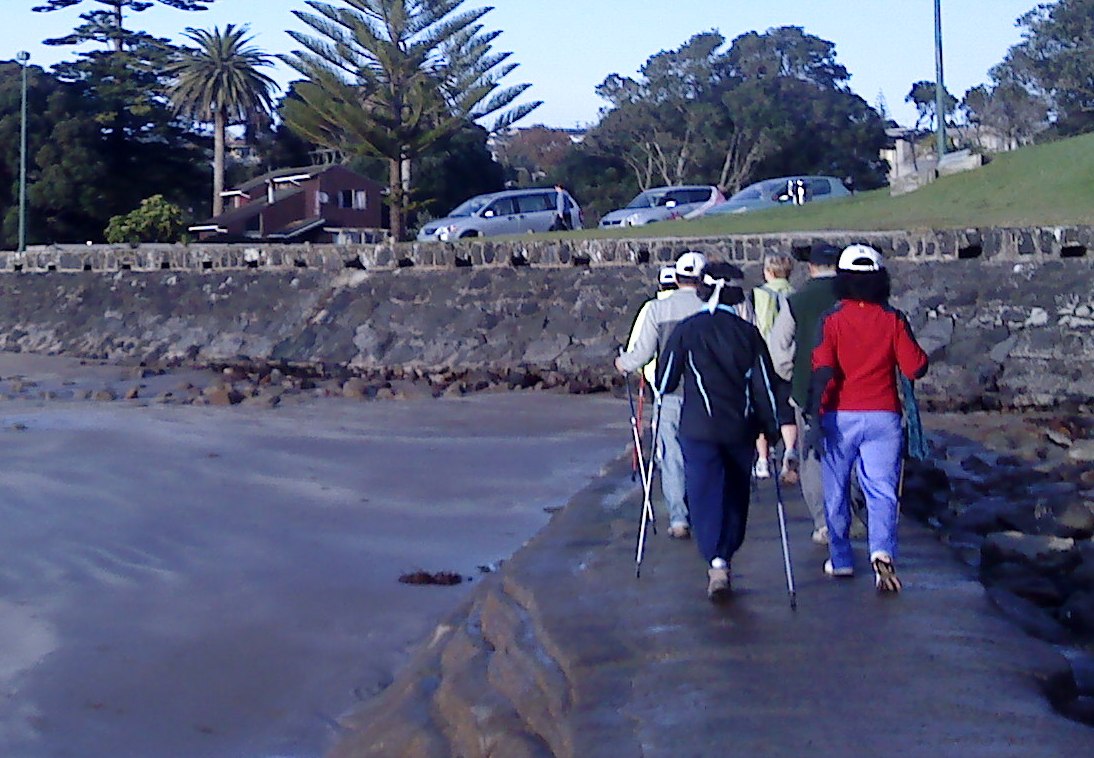
What a glorious day on Sunday and we had a good turn out too. North Shore Nordic Walkers met at Valley Road Car Park in Browns Bay, the sun was shining, the beach was very busy with dog walkers and the tide was on its way out. We poled across the sand to the steps at the Southern end of the beach to Beechwood Road and into Dan Jones Bluff.

Some of the North Shore Nordic Walkers at Browns Bay Beach
I noticed that the empty section at the top of the stairs had been cleared, it’s been neglected for years and it looks like someone is about to build a new home which would have spectacular views overlooking the sea and Browns Bay beach.

Steps to Beechwood Road - Section to the Right
We tramped in single file along the coastal pathway toward Rothesay Bay, where we picked up another Nordic Walker along the way.
The view from the Coastal Track at Murrays Bay
I love this walk. It’s mainly flat although once in Rothesay Bay there is a steep incline up the Rothesay Bay Road before turning left into Churchill Road and taking the Gum Diggers Trail onto Murrays Bay. The coastline is on the left with outstanding views of Rangitoto and the track is concrete all the way down to Murrays Bay Beach. There are three ways of crossing to Mairangi Bay from this point.  You can take the Crow’s Nest Rise Walk along the cliff, take Beach Road or use the man made causeway.  The tide was as I said on it’s way out so we crossed the causeway and made our way across the sand at Mairangi Bay.

Steps to the Gum Diggers Trial at Murrays Bay
I have written about this area in a previous blog Te Ararora – The Long Pathway. The Maori named this piece of land between Mairangi and Murrays Bays Waipapa, which means “water over wood" which was a reference to the stumps and logs left behind from ancient forest that were found in the sand around this area. In 1881 the name had been changed and the bay was renamed after Joseph Murray who farmed the kauri trees on his land between Mairangi Bay and Murrays Bay.

Nordic Walking at Mairangi Bay
The name Mairangi Bay (the sheltered arm) was chosen for the area as it seemed the most appropriate, and this Bay is a small but bustling village of boutique type shops and popular cafes.

The Concrete Causeway at Mairangi Bay
I bought my husband the White’s Aviation Arial photography book a couple of years ago, there are some stunning shots of this area in the book and much of the East Coast Bays on the North Shore in the 1950’s before the Auckland Harbour bridge was built. Check the links below for more information about Leo White and White’s Aviation Company and if you get the chance buy or borrow the book, it’s a great reference book and such an inspiring way to document the history of New Zealand, you can also get more information if you visit the library at MOTAT amongst many other places.

The Steps at Browns Bay to Dan Jones Bluff
We trudged along the beach past the Surf club where we stopped briefly for everyone to catch up before making our way back to Murrays Bay.

At Murrays Bay some of the group decided to take Beach Road back to Browns Bay whilst I and the others mounted the steps back to the Gum Diggers Trail, returning to Rothesay Bay and eventually back down the steps at Beechwood Road to Browns Bay beach.


Coffee at The White Flower, Browns Bay
We usually opt for Ben Gusto for coffee, but this week we tried the White Flower Cafe on Clyde Road, we had a bit of confusion over teas but the service was good and I had a very unhealthy chocolate caramel slice, yummy but made with desicated coconut - not keen.

Information & Sources:

http://www.mairangibayvillage.co.nz/community/mairangibayhistory
http://www.mairangibayvillage.co.nz/sitemap

Saturday, 16 June 2012

Kauri Park


Kauri Park via Rangatira Road

Sunday was a grey day, the forecast was for fine spells with rain and I had organised a walk into a bush area called Kauri Park in Birkenhead.  I arranged to meet everyone at 8.00 am at the Rangatira Road entrance and after a delayed start we set off into the bush keeping to the left and following the track down the steep steps.  I must also mention that to protect the kauri all shoes must be brushed and sprayed before entering this Park and there are cleaning stations available at all entrances.  This is to try and stop soil based disease from damaging the kauri trees and spreading from contaminated shoes.


Kauri Park Tracks
This park has huge kauri trees, I believe that the older trees are actually to the North of the park and are quite easy to spot along the track, the kauri is indigenous to New Zealand. I'm told that they are the "conifer" tree of New Zealand.They can grow to 50 metres in height and originally much of the North of the North Island and Northland would have been covered in kauri.  They are simply one of the most impressive trees I have ever seen; they have huge trunks with girths up to 16 metres. Apparently the bark flakes and sheds from the tree to protect it from invading parasites. Maori used the timber of the tree to make boats, to build with, to make carvings and the gum was mixed with water and plant extract which was then chewed - sort of an early version of chewing gum.

Kauri Trees
The trees are evidence of ancient woods going as far back as the Jurassic age, sadly much of the kauri forests had been plundered by the 1900’s as European settlers arrived the kauri was used for timber and the gum extracted. The young kauri tree was very popular for making masts and spars.  The great kauri forests and bush were cleared to make way for farmland and houses.

Steep Steps and Narrow Tracks
In the early 1920’s 15 acres of this park were first made a public reserve,by Birkenhead Borough Council. A lot of improvements were made, tracks were constructed and entrance gates were made to the tracks in 1931, then in 1948 a serious fire threatened the reserve. A further 5 acres were added to the park in 1965 which was then under the control of the North Shore Scenic Board.

Stopping for a De-robe

The track we followed from Rangatira Road is the beginning of the loop track and to the left the main kauri grove is only few minutes’ walk away. The trees here are around 200 and 400 years old. 

Much of this track is not suitable for Nordic Walking, it’s steep, very slippery and much of it is boardwalk and what isn't boardwalk is narrow in places and riddled with tree root.  It is however beautiful, it’s been lovingly restored with tanekaha and kauri.  The nikau, puriri and many other plants and trees live amongst the kanuka (shrub). It can be quite dark in there as the trees are tall and the canopy is dense in parts.

Very Steep in Places and Slippery Underfoot
We crossed the bridge at the stream which took us past native plants, orchids and ponga trees. Eventually as we walked further we came out at Hebe Place so we turned back and followed the track through to the right but couldn’t pick up the track.

Beautiful Trees, Plants and Bush
Despite having a map we did find following the track difficult, it would be useful if the tracks were marked to make them much easier to find.  However we continued walking through until we came across another entrance at Kauri Road where we continued making our way around the park on the footpath.

Walking through the Street and Back to Rangatira Road
We made our way up the steep Waipa Street, turned right at the corner of Verran Road and continued along Rangatira Road and back to the cars.

We spent a few minutes searching for one of our walkers before making our way over to Verrans Espresso and food.

This is a lovely old fashioned Kiwi cafe, waitress service with a beautiful selection of food and beverages.  The service was excellent and my Blueberry Dazzle smoothie was one of the best I’ve had for a long time and my eggs on toast were scrumptious.

Information & Sources:

http://www.bngcommunitytrust.org.nz/kauri.php
http://www.localhistoryonline.org.nz/cgi-bin/CUI?e=0-------0----------0-1-0-0-&a=d&c=nshore-newspapers&cl=CL3.1980s.1981&d=nsnw-NNI-AAA-9680
http://www.doc.govt.nz/conservation/native-plants/kauri/

Tuesday, 5 June 2012

Shepherds Park – Oruamo Creek

A few peeps were surprised that I had organised a walk on Sunday as it was the Queen’s Birthday weekend.  My philosophy is that I’m sure that the Queen won’t mind and as her royal subjects we owe it to her to keep fit and well.

Shepherds Park, Beach Haven
I chose Shepherds Park as June Stevenson and I have worked there with Green Prescription patients, we’ve only used the footpath and park and when I found that there was a walk around the estuary I was keen to take a look.

Beach Haven is located North West of Auckland city, the first European settlers to this area arrived in the 1860s and until the early 1920s the area was primarily rural consisting mainly of farms growing strawberries and holiday homes (baches).  The area was subdivided for housing later in 1923 and during the construction in 1959 of the Auckland Harbour Bridge the housing development in the area was sufficiently completed to make it into a largely urban populated area.

Making our way to the Bush Walk
Shepherds Park is named after the family who lived there on a farm, originally the area was market gardens before it was developed into a park for community use.  The park offers many amenities including rugby, soccer and tennis; it also features an outdoors fitness circuit for anyone to use.
The headland that is adjacent to the park has been restored to a beautiful bush environment. It’s situated on Hellyer’s Creek and still contains middens from previous Maori occupation. Centuries later Thomas Hellyer opened a kauri mill business in 1840 that supplied timber to Auckland city.

Outstanding views of Hellyers or Oruamo Creek
North Shore Nordic Walkers met at 8.00 am at the park via the Melba Street entrance and parked outside the football (soccer) club. We were joined by June and Paul Stevenson from Nordic Kiwi who were also keen to try the walk.
We started our walk by taking the path on the left past the back of the soccer club, turning right at the Oruama Landing sign we made our way through the bush and onto the track. We followed the track by the coastline though the bush alongside the houses that back onto the water.  

Some of the steps are steep and can be slippery
I’d advise anyone trying this track to take extra care when it’s wet as it is full of tree roots and holes. It is quite boggy in parts although some of the track is boardwalk and there are steps to climb to take in the views of the estuary and the upper harbour, with a backdrop formed by the steep slopes of Greenhithe.

Beautiful tree canopies along the walk and some branches are at head height!
We stopped to look at the views at Hellyers Creek (Maori name is Oruamo which means “for all”) before continuing along the coastal track.  The views are truly outstanding along the estuary, we passed many little wharves some of which looked to be in very precarious positions. The area is marsh wetland and teaming with birds. The plants and trees are magnificent along here, with huge rimu, kauri gum trees and many of New Zealand’s native trees have been replanted by volunteers and the team at the Kaipatiki planting project.

Beautiful views along the estuary track
We proceeded along the track before exiting at Beach Haven Road, turning right we then continued right into Lancaster before taking the left turn back into Melba Street and onto the car park.

Boardwalk view
I think everyone was surprised and delighted at such a beautiful walk that is tucked away on the other side of the park. It’s definitely worth about an hours trip out to walk the area.
One of the small wharves along the way
After a short deliberation we took the cars into the small centre of Beach Haven and walked across to Cafe Au Bon Coin Patisserie, which is on the corner of Rangatira Road. It’s a small establishment but has the friendliest staff with excellent service and I can recommend poached eggs on toast, ils étaient très bons. ; )
Information and Sources: