Showing posts with label Walking sticks. Show all posts

Friday, 11 April 2014

Sanders Reserve - The Faraway Tree


Pam F, one of our Nordic Walkers asked me to accompany her to a place called Sanders Reserve, she had recently taken a Women's Outdoor Pursuits course and did some of her bush survival skills here. She was so taken by this lovely location that she felt she had to show me the area,  I was pleasantly surprised, this is a gorgeous place and a fantastic area to visit for a family or a group outing.


The 'Faraway Tree" - Phil Bonham
Sanders Reserve is about 10 minutes from Albany, it's situated South of Paremoremo and located by the Upper Waitemata Harbour estuary; it's a splendid location, providing areas for dog walking and horse riding. It has a small walking track, a fabulous playground for children and heaps of mountain bike trails with breathtaking views.

Pam took me to see this tree (above) which is along the walking track by an area called Library Point. This is a Macrocarpa (Monterey Cypress) tree and was crafted by Phil Bonham, an Auckland artist and sculptor.

There a wonderful Vimeo clip of Phil talking about his work on the 'Faraway Tree' sculpture, it's a lovely short film that explains where some of his inspiration came from for the figures and animals that are featured in his work.

Take a look: http://vimeo.com/73850678

More information:

http://www.thebigidea.co.nz/work/resumes/133024-phil-bonham
https://www.facebook.com/media/set/?set=a.599621883423361.1073741838.301561623229390&type=3
http://en.wikipedia.org/wiki/Paremoremo

http://www.wops.co.nz/

Thursday, 31 May 2012

Northcote Tuff Crater

The Tuff Crater Restoration Project
The weather on Sunday was ok, despite the downpours during the week the weekend wasn’t too bad at all. It was just as well as I had been advised that the Northcote Tuff Crater (also known as Tank farm) and Onepoto Basin walk was treacherous underfoot when wet.  I was hoping to have a local with us as a guide but unfortunately they were unable to make it so we tramped on regardless.

View from the look out at St Peters Street
The North Shore Nordic Walkers met at the Library at Northcote at 8.00 am.  We walked down College Road crossing over to number 77 turning right onto the walkway in St Peters Street; we stopped at the Crater lookout and then turned right onto the track which was mostly gravel, boardwalk and around wetland. Further on we crossed onto the grass adjacent to the motorway.

Boardwalk around the Crater
Onepoto, (Maori for short beach) is a volcanic crater or maar on the North Shore situated near to the approaches to the Auckland Harbour Bridge, The 26 ha crater is the result of a number of massive eruptions about 250,000 years ago. It first emerged as a freshwater lake, then later became a tidal lagoon when sea levels rose after the last ice age. The crater floor has been reclaimed and now has a sports field, a children’s playground and a lake surrounded with beautiful native bush.  Some areas of the tuff were quarried away in the 1950s to obtain landfill for the Northern Motorway. The tidal Onepoto Stream runs through the swamp under Onewa Cycle Bridge near Waitemata Harbour.

 View from the Motorway Bridge
This area was also known as Tank Farm - the name comes from the  petrochemicals storage tanks which were located here during World War II.
Onepoto Domain
At the end of the walkway we climbed up the steps onto the motorway bridge to take a look at the traffic zipping past; the view of the city is spectacular from the footbridge.  From the bridge we walked back across the grass and past the Pumping Station on the left. Taking a right between the houses we walked though to Heath Ave. Following our map we headed right down Sylvan Avenue where we crossed over to number 72 and along the track to Onepoto Basin. We followed the track through the park to the playground then we heard the loud speakers, Auckland Run Series were having one of their events and we arrived in the middle of it. Curses. Mental note - must check the events calendar for future walks!

Children's Playground
We stopped to look at our map when a helpful young lady came along and gave us directions to another walkway to take us to Northcote Tennis club, unfortunately it clashed with the runners and we tried to find an alternative route. Grace found us a track between the houses but it circled back further along the street so we ended up back in the race;. Curses again. Anyway we meandered for a wee while before deciding to walk facing the runners along the street and exiting Exmouth Road before turning right into College Road and back to the library.

The Lake
We walked though to the shops and found a lovely cafe for our coffee, I had very yellow eggs on toast and was told that they were probably organic although I don’t know as my Nan would say "eggs is eggs", but they tasted superb!

Information & Sources:

http://www.sciencelearn.org.nz/Contexts/Volcanoes/Sci-Media/Animations-and-Interactives/Volcano-map-of-New-Zealand

http://www.theaucklander.co.nz/news/slow-boat-to-danger/1018200/

http://en.wikipedia.org/wiki/Onepoto_(volcanic_crater)

Wednesday, 2 May 2012

Te Ara Alexandra Pathway

North Shore Nordic Walkers met at Rosedale Park on Sunday, it was cold but the rain held, we all met at Jack Hinton Drive and took a stroll down Jack Hinton Drive and into the park.

Rosedale Park North Home of Competitive Softball
There are lots of excavation works going on at the moment; this is for a new stadium and new softball diamonds. Rosedale Sports Stadium will be ready for use in the 2013 season which will be in time for the World softball Championships to be held at Rosedale Park from 1 – 10th March 2013.

There is other work going on there too, it seems that cable installations are in progress from Albany to Wairau and a lot of the park is fenced off at the moment, but as we progressed along our route it was nice to see that the installation of the outdoor exercise equipment was now complete and was being used.

Pam E Demonstrating a Graceful Dismount with Nordic Walking Poles
Coming out of the park and crossing over from Jack Hinton Drive to Barbados Drive and onto the concrete path that runs alongside Alexandra stream we passed though into the tunnel under the Upper Harbour Highway. The painted corrugated tunnel artwork was the handiwork of Jonathan Grange a local and self taught airbrush artist who has done much work on the Shore, it’s painted with bushes and trees making it bright and inviting.

The Airbrushed Tunnel by Jonathan Grange
After a short walk we were on the boardwalk which has been completed and looks terrific, we all marched across making a clatter with our Nordic Walking Poles. It’s much nicer than walking across the path as it is covered with tree trunks and can be dangerous underfoot when it’s wet.

The Beautiful Arum Lily
The bush is really dense along here and is lined with the New Zealand Ponga Trees. The Ponga or Kaponga grows the silver fern that is the national symbol for New Zealand whilst the koru which is often depicted in Maori art is based on the young curled frond of the Ponga leaf, which has the distinctive silver colour on the underside of the leaf and gives it it’s name. The reserve is actually situated between housing and commercial buildings although you would never think that you’re actually still walking in suburbia. I was struck by the huge Arum lilies growing either side of the path and was told that these are probably noxious and extremely poisonous, but they are beautiful to look at and grow wild in New Zealand. A little further along we came across a striking Lilac tree too, it seemed so out of place, typical of an English Garden but didn't seem quite at home in the bush.

The New Wooden Walkway Through the Reserve
Another amazing featue in the bush environment and quite wonderful to look at, are the tiny Gorse Spider Mite webs, these tiny creatures were introduced into New Zealand as a mean of biocontrol. They spin the most intricate, dense cobwebs and tend to cluster in the plant, originally they came from Europe and have been ideal to control infestations of the Gorse plant.

The Intricate and Fibrous Gorse Spider Mite Web
Once out into the open, the path is lined with new exercise equipment which brings you out at Unsworth Heights. This is one of the North Shore’s popular suburban areas particularly for young families and is situated just north of Rosedale and not too far from Glenfield.

Crossing over the road we made our way back to Unsworth Heights Reserve, after a short walk passing more equipment, we arrived at the park however there were further earthworks interrupting the path. Gingerly we climbed across the orange plastic fencing continuing along past the children’s playground, across the street and onto the path back into the reserve.

On the way back instead of turning to the left after leaving the tunnel, we took the gravel  path along the right hand side of the stream, it comes out a little farther along the pavement where we crossed back to Jack Hinton Drive and into Rosedale Park.

Pam E Leading & Demonstrating a Very Graceful Ascent to Unsworth Park
It did start to get a little damp and cold but we managed to keep dry on the short Nordic Walk back to the cars. Once we arrived back at the cars and I had distributed the wipes to clean our poles, we were deep into conversations about the nearest cafe.  It was decided to visit the New Deli Cafe for coffee as most of the Nordic Walkers have been before and it’s got a nice selection of beverages and breakfast items.

Despite much confusion over coffees and what could have been an expensive scrambled egg on toast, the waitresses were quick to sort out our order.  The scrambled eggs on wholemeal toast are recommended, it arrived on my plate looking like a scale model of Rangitoto!

Information & Sources:
http://www.sportsground.co.nz/Article.asp?SiteID=5630&ArticleID=13835
https://www.asa.ac.nz/documents/transport/albanynewsletter1.pdf
http://www.aucklandtransport.govt.nz/moving-around/delays-roadworks/CurrentRestrictions/Pages/Te-Ara-Alexandra-Cycle-Walkway-Tunnel-Upgrade.aspx

Tuesday, 24 April 2012

Hobsonville Point

Last week we had a local walk and I didn’t really have much to say about it, but this Sunday North Shore Nordic Walkers met at Hobsonville in the morning; we parked opposite the Catalina Cafe and it was quite an adventure. I copied a map from the Internet to try a walk around Hobsonville Point. Unfortunately some of the walk had been interrupted by earthworks for new housing and school development and a good portion of it wasn’t easy to access.  The place was really busy though, they have a traditional farmers market on a Sunday at 9.00 am and the place was already bustling as we passed through.

The Catalina Cafe
We crossed over the road at the Corner of Buckley Ave and Hastings Crescent and walked around the back of Catalina Cafe. We poled past the community plant network garden, down past the children’s playground and past many of the old service buildings.   

The Quaint Church or Pump House
Hobsonville Point was previously the Royal New Zealand Air Force airfield, set aside for development at the start of the millennium and is now emerging as a new semi rural suburb of Auckland, located on the North Western shore of Waitamata Harbour and named after the first governor of New Zealand.

Signposts around the Coastal Walk Path
Originally the area was used for farming, what I found interesting and a few of our walkers commented on, was that the earth that had been dug up by the bulldozers was mainly clay.  Apparently there were clay and brickworks in the area and most of the pipe work in Auckland would have been made there.
Some of our Nordic Walkers at the Landing
In the 1920’s the Royal New Zealand Air Force built the airbase which later joined up with Whenuapai airfield. Later in the 1930’s the air strip was evidently too short and the area was used as a repair and equipment utility.  Eventually in early 2000  the RNZAF relocated most of its logistics and operations elsewhere.
Walking through the old air base was really kind of eery, we all had that feeling that we shouldn’t be there, there were lots of signs stating that the area was strictly for Defence personnel only.

We made our away across the tarmac path and down to the Landing, this area was used by the old seaplanes, it’s a small concreted area that faces the sea, this will become the new Hobsonville wharf and ferry terminal.

View from the Landing
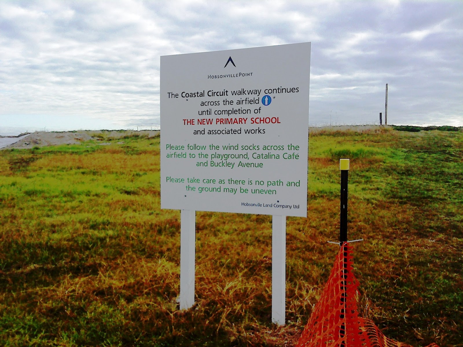
Eventually we came across signposts that lead us onto Bomb Point, it looked like there was a path in the grass and another walk.  We didn’t venture down the path but continued to the airfield where a sign told us to look out for the wind socks. Well with no wind socks in view we picked our way across the building site and walked across to where the new primary school would eventually be built.

Sign for Bomb Point which wasn't half as exciting as we expected
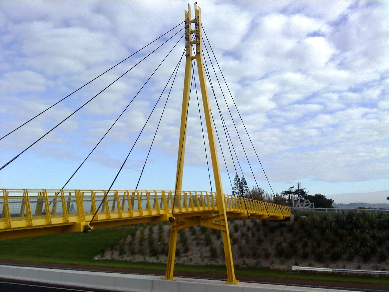
It was at this point when we came across a couple of ladies we saw earlier on the car park outside the Catalina cafe. I asked about any further walks and they pointed us in the direction of the yellow bridge so away we tramped, passing a pump station that we thought at first was a small church. We crossed over the road and made our way across the Memorial Park and onto Clarks Lane Footbridge.

Not a single windsock in sight!
The bridge is indeed canary yellow and is tiled at the edges with beautiful details, each tile along the end had some cycle or truck tread artwork being the creation of Matt and Kate McLean. They have been put together most decoratively and add a lovely touch to what could have been a boring path across a very busy highway.

From the bridge you can see what would have been some of the homes used by the pilots whilst working at Whenuapai airfield.  Mary pointed out some of the traditional houses and from where we stood we could also take a good view of the Sinton Windows Sculpture which was apparently created using recovered materials.
Clark Lane Footbridge
We were now ready for a coffee so we headed back past the park towards the cafe, however as usual we were distracted by the new housing development and took a slight detour to have a nosey at the new homes. 
Once satisfied that we weren't missing anything we ventured back past a lovely kiddies playground and onto the Catalina Cafe.

Matt and Kate McLean Tiles
The cafe was doing a roaring trade with hungry shoppers and walkers, however the queuing was short and service was fast, and I had two poached eggs on toast with lemon and ginger tea!  Some of the group went off to see the farmers market and the remainder made our way back to the car park.

Sinton Windows Sculpture
I think we’ll be returning to Hobsonville as it’ll be interesting to see the finished result - I might even go back and explore some of the other paths.

Information and Sources:
http://www.arc.govt.nz/albany/fms/main/Documents/Council/Consents/Notified%20applications/HobsonvilleLandco/Appendix%2010-21/Appendix%2010%20-%20Archaeological%20Assessment.pdf


Thursday, 23 February 2012

The Lucas Creek Walkway

A few of the North Shore Nordic Walkers met at Kell Drive on Sunday to explore Kell Park once again.  It was pretty cold in the morning and the mist was still hanging in the air and the grass was very wet!
Kell park, Albany

One of our regular walkers Pam E passed some walking books to me a few weeks ago, one of which was Explore the Shore, Volume One, Albany& Greenhithe Area Walks.  The booklets are available online or you can collect them from the library and information centres.

Cannon at the top of the Walkway overlooking the creek
The books have been put together by a lady called Margaret Scrymygeour, they are beautifully illustrated with maps and written instructions on local walks.
I have met Margaret at one of the Walk to Work events in Takapuna in 2010 organised by Living Streets Aotearoa and Auckland City Council.  Margaret is a lovely lady with heaps of local knowledge and she put the maps together a while ago; I've used The Harbour Sports website to print her maps, its lovely to see them all professionally published and presented in these wonderful booklets.
As we had already been to Kell Park and wandered about there the previous week I decided that we should try the Kell Park and Lucas Creek Track and take the 5 km walk that features in the booklet.
The painted chooks and some of our Nordic Walkers

We met at the car park which is located in Kell Drive behind the shops and library at Albany.  This is a recently developed suburban area with lots of lovely houses which run adjacent to one of the local and oldest waterways.
Following the instructions we followed the path down to the Creek and took the left hand walkway across the footbridge, walking along the concrete footpath and turned right across the grass into the Nature Reserve. We walked across with wet trainers until we reached Wharf Road and at the signpost for the Reserve we went straight over Wharf Road and continued along the grass, and crossed over onto the Lucas Creek Walkway.

The huge slide at Kell Park
At Kinleith Way there is an exit into a walkway between a couple of houses and crossing the road,  we encountered another walkway which exited at Mahoney Drive, which passed through a third walkway further along Mahoney Drive and exited into Vinewood Drive. 

Following our map we continued and took a right at the playground into Roanoak Way taking yet another walkway between the houses and that’s where it all became very confusing.

Beautiful carved wooden chair in the park
Alan had joined us for our walk this week, Alan usually walks with the group in Northcote but has brought his poles along to walk with us before.  Alan and I agreed that at this point the instructions were a bit confusing so we took a right and followed the path back and eventually made our way to Wharf Road and onto The Landing. What we should have done really was go back across the wet grass to Wharf Road. From The Landing we took a right into Landing Drive and at Widdison Way we crossed over to the walkway and then made our way back to the Nature Reserve.

The Albany Village Logo
We followed the footpath back to Kell Park and back up to the platform where we had earlier met a few of the local dog owners, one of which had tried Nordic Walking at Long Bay in the past. I love the cannon here and there's a huge slide as I mentioned last week and down the steps to the left is the flying fox. We could see eels swimming in the creek below.

At the end of the walk we had the opportunity to stroll around the fruit trees by the children's playground and had a debate over some of the fruit and  what we thought was a pear tree is actually a quince.  There are also some wonderful wooden sculptures in this area, one of which is an enourmous wooden chair beautifully carved from a tree trunk.

After talking for a while we made our way back to the cars and had a coffee at the Opium Cafe, however being so early  on a Sunday we had to take a stroll for 10 minutes while they opened. Despite the dubious name the cafe serves excellent blueberry muffins!

The Chooks
It’s worth noting that there will be Art in the Park next weekend at Kell Park, and if you’re free take the kids or grand children, it’s a great venue and there are some intersting sculptures dotted around.

Make sure you look out for the beautiful painted chooks on the wall.